
IMAGES TAKEN NEAR TO
George Road, KNIGHTON, LD7 1HF
Introduction
This page details the photographs taken nearby to George Road, LD7 1HF by members of the Geograph project.
The Geograph project started in 2005 with the aim of publishing, organising and preserving representative images for every square kilometre of Great Britain, Ireland and the Isle of Man.

There are currently over 7.5m images from over14,400 individuals and you can help contribute to the project by visiting https://www.geograph.org.uk
Image Map
Images are licensed for reuse under creativecommons.org/licenses/by-sa/2.0
Notes
- Clicking on the map will re-center to the selected point.
- The higher the marker number, the further away the image location is from the centre of the postcode.
Image Listing (322 Images Found)
Images are licensed for reuse under creativecommons.org/licenses/by-sa/2.0
Image
Details
Distance
1

Misty Knighton morning
Early, misty morning Autumn view over Knighton from the Garth lane
Image: © Peter Evans
Taken: 10 Oct 2009
0.01 miles

3
![Knighton houses [11]](https://s0.geograph.org.uk/geophotos/06/94/17/6941768_15dfff9b_120x120.jpg)
Knighton houses [11]
Numbers 11 and 12 The Cwm lie on the south bank of Wylcwn Brook and are glimpsed from George Road. The semi-detached properties have stone built ground floors and square panelled timber framing with rendered infill to the upper floors, all under a slate roof. Listed, grade II, with details at: https://cadwpublic-api.azurewebsites.net/reports/listedbuilding/FullReport?lang=&id=8986 (number 11) and at: https://cadwpublic-api.azurewebsites.net/reports/listedbuilding/FullReport?lang=&id=8987
Knighton is a somewhat remote market town gaining its charter in 1203. It is sited on the River Teme some 60 miles north of Cardiff. It lies on the Welsh/English border, with a small part in Shropshire, including its railway station. Originally an Anglo-Saxon settlement, Knighton is located on Offa's Dyke, the ancient earthwork that divided the two countries. It later became a Norman defensive border town.
Image: © Michael Dibb
Taken: 31 May 2021
0.02 miles
4
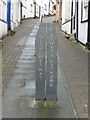
Glyndwr's Way marker stone at the start/end of the path
Image: © Dave Kelly
Taken: 15 Sep 2015
0.03 miles
5

Stream beside Glyndwr's Way in Knighton
A pleasant sound from the stream as we pass.
Image: © Jeremy Bolwell
Taken: 26 May 2014
0.04 miles
6
![Knighton houses [10]](https://s1.geograph.org.uk/geophotos/06/94/17/6941745_80f2fab3_120x120.jpg)
Knighton houses [10]
Almost hidden behind the hedge in Castle Road is White House. Probably built in the 18th century but incorporating parts of an earlier building to the rear which is within the castle bailey. Constructed of roughcast rendered brick under a slate roof. Under the rear garden is a late 16th or early 17th century barrel-vaulted undercroft. Listed, grade II, with details at: https://cadwpublic-api.azurewebsites.net/reports/listedbuilding/FullReport?lang=&id=8975
Knighton is a somewhat remote market town gaining its charter in 1203. It is sited on the River Teme some 60 miles north of Cardiff. It lies on the Welsh/English border, with a small part in Shropshire, including its railway station. Originally an Anglo-Saxon settlement, Knighton is located on Offa's Dyke, the ancient earthwork that divided the two countries. It later became a Norman defensive border town.
Image: © Michael Dibb
Taken: 31 May 2021
0.04 miles
7
![Knighton houses [22]](https://s3.geograph.org.uk/geophotos/06/94/43/6944375_b16c0f73_120x120.jpg)
Knighton houses [22]
Cefnlly's, number 6 George Road, is an early 19th century house. Constructed of rendered brick under a slate roof. Listed, grade II, with details at: https://cadwpublic-api.azurewebsites.net/reports/listedbuilding/FullReport?lang=&id=8988
Knighton is a somewhat remote market town gaining its charter in 1203. It is sited on the River Teme some 60 miles north of Cardiff. It lies on the Welsh/English border, with a small part in Shropshire, including its railway station. Originally an Anglo-Saxon settlement, Knighton is located on Offa's Dyke, the ancient earthwork that divided the two countries. It later became a Norman defensive border town.
Image: © Michael Dibb
Taken: 31 May 2021
0.06 miles
8
![Knighton features [10]](https://s3.geograph.org.uk/geophotos/06/94/17/6941743_11a2a9ad_120x120.jpg)
Knighton features [10]
At a number of locations in the town are these 'bone' signs, each sponsored by a business. Attached to each sign is a supply of dog poo bags. What an excellent idea to help keep the town clean.
Knighton is a somewhat remote market town gaining its charter in 1203. It is sited on the River Teme some 60 miles north of Cardiff. It lies on the Welsh/English border, with a small part in Shropshire, including its railway station. Originally an Anglo-Saxon settlement, Knighton is located on Offa's Dyke, the ancient earthwork that divided the two countries. It later became a Norman defensive border town.
Image: © Michael Dibb
Taken: 31 May 2021
0.06 miles
9
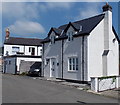
Knoll Cottage, Knighton
Viewed across Castle Road.
Image: © Jaggery
Taken: 26 Aug 2013
0.06 miles
10

Mill Road, or the Cwm, Knighton, Powys
View Eastwards along Mill Road, also called The Cwm, in Knighton, Powys.
http://en.wikipedia.org/wiki/Knighton,_Powys
Image: © Peter Evans
Taken: 13 Aug 2014
0.06 miles