1
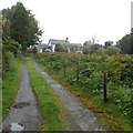
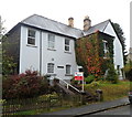
Llanwrtyd Wells
A glimpse of Llanwrtyd Wells across a meadow.
Image: © Alan Hughes
Taken: 24 Feb 2019
0.03 miles
2
Entrance drive to Llanwrtyd Hall, Llanwrtyd
The 90 metre long entrance leads from Station Road
to Llanwrtyd Hall Country House B&B (bed and breakfast accommodation).
Image: © Jaggery
Taken: 30 Sep 2012
0.04 miles
3
Layton Close, Llanwrtyd Wells
Layton Close is small cul-de-sac of 6 houses, of which 4 are in view.
Viewed from Irfon Terrace.
Image: © Jaggery
Taken: 30 Sep 2012
0.06 miles
4
Corner of Irfon Terrace and Berthllwyd, Llanwrtyd Wells
Houses located on the east side of the centre of the small town.
Image: © Jaggery
Taken: 30 Sep 2012
0.06 miles
5
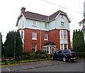
Lasswade, Llanwrtyd Wells
Lasswade Country House Hotel and Restaurant in near Llanwrtyd station.
Image: © Philip Halling
Taken: 22 Mar 2009
0.07 miles
6
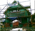
New house under construction
Image: © Alex McGregor
Taken: 17 Jul 2012
0.07 miles
7
Lasswade, Llanwrtyd Wells
Country house and restaurant located on Station Road, about 300 metre from Llanwrtyd railway station http://www.geograph.org.uk/photo/3157223 and a similar distance from the centre of the small town.
Image: © Jaggery
Taken: 30 Sep 2012
0.08 miles
8
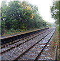
Longer platform 2 at Llanwrtyd railway station
Viewed from the end of platform 1. Platform 2, for southbound trains, extends beyond platform 1.
The distant red dots are part of stop signs near the point where the two tracks through the station merge into one track. The signs instruct the driver to obtain the single-track token, and permission to proceed, before leaving the station.
Image: © Jaggery
Taken: 30 Sep 2012
0.10 miles
9
The Old Court House, Llanwrtyd Wells
The Station Road house has retained features from its former use as the local court house. These include the former magistrates' court room with high beamed ceilings. In the inner hallway are openings to two former holding cells with the original cell doors and arched ceiling and windows.
Image: © Jaggery
Taken: 30 Sep 2012
0.10 miles
10
Askomel, Llanwrtyd Wells
The Station Road guest house is opposite Llanwrtyd railway station. http://www.geograph.org.uk/photo/3157223
Askomel was built in 1868, at about the time the station first opened.
Image: © Jaggery
Taken: 30 Sep 2012
0.10 miles


