1
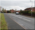
A side arm of Pontwilym, Brecon
Viewed along the main road through Pontwilym, a residential area at the northern edge of Brecon.
A sign shows that this turning leads to numbers 19-44.
Image: © Jaggery
Taken: 11 Sep 2011
0.06 miles
2
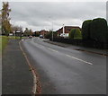
Road through Pontwilym and Beacons Park, Brecon
This is the main road through a residential area at the northern edge of Brecon.
The playground sign is near this http://www.geograph.org.uk/photo/3403365 play area.
Image: © Jaggery
Taken: 11 Sep 2011
0.07 miles
3
Pontwilym towards Beacons Park, Brecon
Road through an area of modern houses at the northern edge of Brecon, east of the B4520. The bus stop on the right is on Route 40B Brecon Town Service to Brecon Interchange https://www.geograph.org.uk/photo/3376531. In early November 2018 departures are hourly from 10am to 6pm every day except Sunday when there is no service.
Image: © Jaggery
Taken: 4 Nov 2018
0.08 miles
4
Western edge of Beacons Park, Brecon
Viewed along the main road through a residential area at the northern edge of Brecon.
Viewed from Pontwilym, which occupies the western side, looking towards the lamppost bearing the sign for Beacons Park, on the eastern side.
Image: © Jaggery
Taken: 11 Sep 2011
0.09 miles
5
East along Pontwilym, Brecon
From the B4520 at the northern edge of Brecon, Pontwilym leads to houses in Beacons Park. The bus shelter is alongside a stop on Route 40B Brecon Town Service from/to Brecon Interchange in the centre of Brecon.
Image: © Jaggery
Taken: 4 Nov 2018
0.09 miles
6
A corner of Pontwilym, Brecon
Pontwilym is a residential area at the northern edge of Brecon.
Image: © Jaggery
Taken: 11 Sep 2011
0.09 miles
7
A southern side arm of Pontwilym, Brecon
One of several side arms aligned at right angles on either the north or south side of the main west-east course of Pontwilym. This one is on the south side, near the B4520 junction.
Image: © Jaggery
Taken: 4 Nov 2018
0.10 miles
8
Children's play area, Pontwilym, Brecon
Located on the north side of Pontwilym, an area of housing at the northern edge of Brecon.
Image: © Jaggery
Taken: 11 Sep 2011
0.11 miles
9
Bungalows opposite a bend in Pendre Close, Brecon
Originally, bungalow was used in English for a lightly-built house, with a veranda and one storey.
In current UK usage it is a convenient word for any one-storey dwelling.
Image: © Jaggery
Taken: 4 Nov 2018
0.11 miles
10
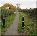
Path on the east side of Pendre Close, Brecon
Towards Beechgrove.
Image: © Jaggery
Taken: 4 Nov 2018
0.12 miles


