IMAGES TAKEN NEAR TO
Sennybridge, BRECON, LD3 8TW

Introduction

This page details the photographs taken nearby to LD3 8TW by members of the Geograph project.

The Geograph project started in 2005 with the aim of publishing, organising and preserving representative images for every square kilometre of Great Britain, Ireland and the Isle of Man.

There are currently over 7.5m images from over14,400 individuals and you can help contribute to the project by visiting https://www.geograph.org.uk

Image Map


Images are licensed for reuse under creativecommons.org/licenses/by-sa/2.0
Notes
  • Clicking on the map will re-center to the selected point.
  • The higher the marker number, the further away the image location is from the centre of the postcode.

Image Listing (29 Images Found)

Images are licensed for reuse under creativecommons.org/licenses/by-sa/2.0
  • ...
Image
Details
Distance
1
Houses at Coed Waen Cqar
These houses are on the minor road that leads down to the bridge over the River Usk and then on to Pentre'r Felin.
Image: © Nigel Mykura Taken: 1 Jul 2015
0.05 miles
2
Pont Llwyncyntefin near Sennybridge
Image: © Nigel Davies Taken: 28 May 2007
0.05 miles
3
Two rusty corrugated buildings and a bus shelter, Sennybridge
Located on the corner of the A40 and the road to Pentre'r-felin via Pont Llwyncyntefin http://www.geograph.org.uk/photo/448060 over the River Usk.
Image: © Jaggery Taken: 24 Jul 2011
0.06 miles
4
Bridge over the Usk, near Sennybridge
Image: © Roger Cornfoot Taken: 22 Nov 2008
0.06 miles
5
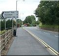
Sennybridge: A40 approaches a junction
Turn left ahead for Pentre'r-Felin, Pentrebach and Llandeilo'r-Fan.
Image: © Jaggery Taken: 24 Jul 2011
0.06 miles
6
Ordnance Survey Cut Mark
This OS cut mark can be found on the NW buttress of the railway bridge remains. It marks a point 195.910m above mean sea level.
Image: © Adrian Dust Taken: 7 Apr 2019
0.07 miles
7
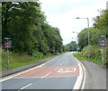
A40 heads NE away from Sennybridge
The speed limit increases from 30mph to 40mph on the A40 outside the main residential area of Sennybridge. Brecon is about 10 miles ahead.
Image: © Jaggery Taken: 24 Jul 2011
0.08 miles
8
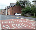
Slow down in High Street, Sennybridge
There are large white-on-red signs on the High Street road surface, in English and Welsh (ARAF).
Image: © Jaggery Taken: 24 Jul 2011
0.14 miles
9
Site of Devynock & Sennybridge station
View eastward on the A40 road towards Brecon: ex- GWR (Neath & Brecon) Brecon - Neath (Riverside) line. The line had been closed from 15/10/62, but the track-bed over this bridge was utilised for the A4067 by-pass road: the station had been off to the right.
Image: © Ben Brooksbank Taken: 1 Jun 1993
0.18 miles
10
Ordnance Survey Cut Mark
This OS cut mark can be found on an old shop on the NW side of the road. It marks a point 195.288m above mean sea level.
Image: © Adrian Dust Taken: 21 May 2016
0.18 miles
  • ...