1
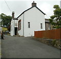
Welsh Rarebit
Cafe in Defynnog.
Image: © Alan Hughes
Taken: 28 Apr 2022
0.00 miles
2
Defynnog, Phone Box in Garden
This telephone box appears to be sited in its original position, and if you look on the map here you will see it shown as a working box ... it isn't - it is a private box with an old A/B Telephone in it complete with directories and the door padlocked up with a note on it about the box. Interesting that Ordnance Survey still have it shown as a working box. Nearest box is outside the church, just a short walk away.
Image: © Nick Mutton 01329 000000
Taken: 8 Jul 2007
0.00 miles
3
The International Welsh Rarebit Centre, High Street, Defynnog
Image: © Jeff Gogarty
Taken: 11 May 2019
0.01 miles
4
House at the northern end of High Street, Defynnog
A view from the A4067 along the A4215, which here is named High Street, Defynnog.
Image: © Jaggery
Taken: 24 Jul 2011
0.01 miles
5
The Old School Craft Shop and Restaurant, Defynnog
Located on High Street, viewed from the A4067 side near The Tanners Arms. http://www.geograph.org.uk/photo/2648199
Art gallery, craft centre and antiques, with licensed Victorian tea rooms.
Image: © Jaggery
Taken: 24 Jul 2011
0.01 miles
6
House on the High Street, Defynnog
Image: © Jeff Gogarty
Taken: 11 May 2019
0.02 miles
7
Fforest Fach overlooks Defynnog
Taken from the A4125.
Image: © Jeff Gogarty
Taken: 11 May 2019
0.02 miles
8
Between the house at Defynnog
The moorland, Fforest Fach, is split by Cwm Clydach.
Image: © Jeff Gogarty
Taken: 11 May 2019
0.02 miles
9
Ordnance Survey Cut Mark
This OS cut mark can be found on the NW angle of the house east side of the road. It marks a point 197.472m above mean sea level.
Image: © Adrian Dust
Taken: 21 May 2016
0.03 miles
10
The Tanner's Arms, Defynnog
A fine pub, though not quite as fine as it was later in the evening once it had opened.
Image: © John Winder
Taken: 11 Nov 2014
0.03 miles


