1
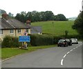
Sennybridge Sign
Sennybridge Sign on Defynnog Road
Image: © Lee
Taken: 10 Jul 2014
0.01 miles
2
Southern boundary of Sennybridge
A view NW along Defynnog Road.
Image: © Jaggery
Taken: 24 Jul 2011
0.03 miles
3
Southern approach to Sennybridge
Dwellings on short cul-de-sac next to A4067. The woodland on the skyline is on Yr Allt.
Image: © M J Roscoe
Taken: 23 May 2022
0.05 miles
4
Northern boundary of Defynnog
Defynnog is a small village immediately south of Sennybridge. Viewed along the A4067.
Image: © Jaggery
Taken: 24 Jul 2011
0.07 miles
5
A view north across Sennybridge football pitch
A late-July view from the edge of the football pavilion http://www.geograph.org.uk/photo/2649439 towards houses at the southern edge of Sennybridge. The football pitch appears to be unused during the close season, allowing the grass and field flowers the chance to grow.
Image: © Jaggery
Taken: 24 Jul 2011
0.07 miles
6
20mph zone ahead, Defynnog Road, Sennybridge
When the lights on the sign are showing, the speed limit reduces to 20mph on the approach to Sennybridge Primary School.
Image: © Jaggery
Taken: 24 Jul 2011
0.07 miles
7
Sennybridge : Defynnog Road houses viewed from near the Coedbach junction
Viewed along Defynnog Road past the left turn into a cul-de-sac, Coedbach.
Image: © Jaggery
Taken: 24 Jul 2011
0.07 miles
8
Sports field, Sennybridge
The field lies between the Afon Senni
Image and the A4067, to the right.
Image: © M J Roscoe
Taken: 29 Sep 2019
0.10 miles
9
Sennybridge Health Centre
Located on Defynnog Road, the health centre is a branch surgery of Brecon Medical
Group Practice, whose main surgery is at Ty Henry Vaughan, Bridge Street, Brecon. http://www.geograph.org.uk/photo/3004213
Image: © Jaggery
Taken: 24 Jul 2011
0.11 miles
10
A4067 crossroads south of Sennybridge
Running left to right, a minor road crosses the A4067, which heads towards the southern edge of Sennybridge.
Image: © Jaggery
Taken: 24 Jul 2011
0.12 miles


