1
Corner houses in Libanus, Powys
The A470 side of houses on the corner of the minor road to the Brecon Beacons National Park Visitor Centre.
Image: © Jaggery
Taken: 7 Apr 2019
0.00 miles
2
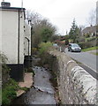
Stream in Libanus, Powys
Here below the minor road to the Brecon Beacons National Park Visitor Centre, the stream flows towards the camera near the corner of the A470. The stream is Cwm Clun, a tributary of the Afon Tarell, into which it flows about 150 metres away.
Image: © Jaggery
Taken: 7 Apr 2019
0.01 miles
3
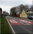
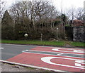
50 on the A470 in Libanus, Powys
The A470 ascends away from the southern edge of Libanus in the Brecon Beacons National Park.
Image: © Jaggery
Taken: 7 Apr 2019
0.02 miles
4
Turn left for Visitor Centre, Libanus
The sign shows that the (Brecon Beacons) National Park Visitor Centre is a mile and a half from this point on the A470 in the village of Libanus. The wall on the right is at the edge of a conduit conveying a small stream under the road. The stream is Cwm Clun, a tributary of the Afon Tarell, which in turn is a tributary of the River Usk.
Image: © Jaggery
Taken: 28 Aug 2011
0.02 miles
5
Steps up to a public footpath, Libanus, Powys
From the east side of the A470 to this https://www.geograph.org.uk/photo/6112924 public footpath.
Image: © Jaggery
Taken: 7 Apr 2019
0.02 miles
6
Roadside mirror, Libanus, Powys
Alongside the A470, the main road through Libanus in the Brecon Beacons National Park.
Image: © Jaggery
Taken: 7 Apr 2019
0.02 miles
7
A470 direction signs in Libanus, Powys
Facing the minor road from the Brecon Beacons National Park Visitor Centre.
Left for Brecon (Aberhonddu in Welsh), right for Merthyr Tydfil (Merthyr Tudful in Welsh).
Image: © Jaggery
Taken: 7 Apr 2019
0.02 miles
8
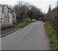
Minor road from Libanus to the Brecon Beacons National Park Visitor Centre
The A470 junction is behind the camera. The Visitors Centre is about 2.5 km (a mile and a half) ahead. In the background, the 50mph speed limit increases to the National Speed Limit.
Image: © Jaggery
Taken: 7 Apr 2019
0.02 miles
9
National Park Visitor Centre direction sign, Libanus, Powys
The brown sign alongside the A470 points towards the minor road to the Brecon Beacons National Park Visitor Centre a mile and a half away. The sign text is also in Welsh.
Image: © Jaggery
Taken: 7 Apr 2019
0.03 miles
10
Northern edge of a burial ground, Libanus, Powys
The far side of this https://www.geograph.org.uk/photo/6112904 burial ground viewed from a public footpath. https://www.geograph.org.uk/photo/6112924
Image: © Jaggery
Taken: 7 Apr 2019
0.03 miles


