IMAGES TAKEN NEAR TO
Cathedine, BRECON, LD3 7TQ

Introduction

This page details the photographs taken nearby to LD3 7TQ by members of the Geograph project.

The Geograph project started in 2005 with the aim of publishing, organising and preserving representative images for every square kilometre of Great Britain, Ireland and the Isle of Man.

There are currently over 7.5m images from over14,400 individuals and you can help contribute to the project by visiting https://www.geograph.org.uk

Image Map


Images are licensed for reuse under creativecommons.org/licenses/by-sa/2.0
Notes
  • Clicking on the map will re-center to the selected point.
  • The higher the marker number, the further away the image location is from the centre of the postcode.

Image Listing (26 Images Found)

Images are licensed for reuse under creativecommons.org/licenses/by-sa/2.0
  • ...
Image
Details
Distance
1
Lane past Wern-ddu
The woodland to the left is cathedine Common; the hill in the centre distance is Allt yr Esgair (393m).
Image: © Jonathan Billinger Taken: 14 Jan 2015
0.02 miles
2
Country lane
Approaching Wern-Ddu.
Image: © Alan Hughes Taken: 6 Sep 2024
0.05 miles
3
Country lane
Near Cathedine.
Image: © Alan Hughes Taken: 6 Sep 2024
0.08 miles
4
Minor road, Cathedine
Viewed across the B4560. The road leads to the south side of Llangors Lake. A sign warns of a weak bridge ¾ mile head. The weight limit on the sign is partly hidden by vegetation.
Image: © Jaggery Taken: 18 Sep 2011
0.17 miles
5
Traffic signs and a gnarled oak near Cathedine
Located alongside the B4560 opposite Upper Cathedine Farm. http://www.geograph.org.uk/photo/3539053
Image: © Jaggery Taken: 18 Sep 2011
0.19 miles
6
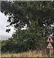
Tree behind two warning signs, Cathedine, Powys
Alongside the B4560 opposite Upper Cathedine Farm.
Image: © Jaggery Taken: 27 Aug 2023
0.19 miles
7
Feeding time at Lower Cathedine
Image: © Philip Pankhurst Taken: 19 Apr 2015
0.20 miles
8
St Michael, Cathedine
Tower and chancel by E.H. Martineau in 1868, the nave by S.W Williams in 1894. Disused and awaiting its fate, but with evidence of remaining care in the churchyard.
Image: © Philip Pankhurst Taken: 19 Apr 2015
0.20 miles
9
Ordnance Survey Cut Mark
This OS cut mark can be found on the south face of St Michael's Church. It marks a point 185.279m above mean sea level.
Image: © Adrian Dust Taken: 21 Apr 2016
0.20 miles
10
Upper Cathedine Farm south of Cathedine
Viewed from the B4560.
Image: © Jaggery Taken: 18 Sep 2011
0.20 miles
  • ...