IMAGES TAKEN NEAR TO
Lon Slwch, BRECON, LD3 7RL

Introduction

This page details the photographs taken nearby to Lon Slwch, LD3 7RL by members of the Geograph project.

The Geograph project started in 2005 with the aim of publishing, organising and preserving representative images for every square kilometre of Great Britain, Ireland and the Isle of Man.

There are currently over 7.5m images from over14,400 individuals and you can help contribute to the project by visiting https://www.geograph.org.uk

Image Map


Images are licensed for reuse under creativecommons.org/licenses/by-sa/2.0
Notes
  • Clicking on the map will re-center to the selected point.
  • The higher the marker number, the further away the image location is from the centre of the postcode.

Image Listing (83 Images Found)

Images are licensed for reuse under creativecommons.org/licenses/by-sa/2.0
  • ...
Image
Details
Distance
1
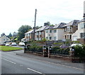
Brecon - Housing Estate With A View
Image: © Peter Whatley Taken: 18 Jul 2009
0.03 miles
2
Brecon - Woodland Crescent Corner
In the background is one of the gates to Deering Lines barracks.
Image: © Peter Whatley Taken: 18 Jul 2009
0.05 miles
3
Brecon - Housing Estate East Of Town
Image: © Peter Whatley Taken: 18 Jul 2009
0.06 miles
4
Dorlangoch houses, Brecon
Dorlangoch is a group of houses extending for about 200 metres on the north side of the B4601. This is the eastern part of Dorlangoch, set back about 20 metres from the road.
Image: © Jaggery Taken: 10 Jul 2011
0.07 miles
5
Rivet Benchmark on Milestone
Originally 10m to the West, when the Benchmark would have represented 132.1 m Above Seal Level. For the view of the milestone see Image
Image: © Mr Red Taken: 8 May 2021
0.08 miles
6
Old Milestone, B4601
Originally 10m West in the pavement, in front of the garden wall. Moved within the last 10 years to allow off-street parking for the property. Rivet Benchmark on top representing 132.1 m ASL. see Image Brecon / 1 Milestone Society National ID: BRE_BCAG01
Image: © Mr Red Taken: 8 May 2021
0.08 miles
7
Pen-y-bryn houses, Brecon
Pen-y-bryn is a square-shaped cul-de-sac near the eastern edge of Brecon. Each side is about 80 metres long. Seen here are houses on the southern side of the square, viewed from near the corner of Lon Slwch. http://www.geograph.org.uk/photo/2450561
Image: © Jaggery Taken: 29 May 2011
0.08 miles
8
Ordnance Survey Rivet
This OS rivet can be found on the milestone north side of the road. It marks a point 132.110m above mean sea level.
Image: © Adrian Dust Taken: 16 Aug 2022
0.08 miles
9
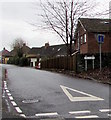
East along L?n Slwch, Brecon
The Lôn Slwch name sign and a No Through Road sign are on the right.
Image: © Jaggery Taken: 24 Nov 2019
0.08 miles
10
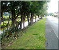
Tree-lined canal, Brecon
Trees separate the Monmouthshire and Brecon Canal from the B4601.
Image: © Jaggery Taken: 10 Jul 2011
0.09 miles
  • ...