IMAGES TAKEN NEAR TO
Llyswen, BRECON, LD3 0YE

Introduction

This page details the photographs taken nearby to LD3 0YE by members of the Geograph project.

The Geograph project started in 2005 with the aim of publishing, organising and preserving representative images for every square kilometre of Great Britain, Ireland and the Isle of Man.

There are currently over 7.5m images from over14,400 individuals and you can help contribute to the project by visiting https://www.geograph.org.uk

Image Map


Images are licensed for reuse under creativecommons.org/licenses/by-sa/2.0
Notes
  • Clicking on the map will re-center to the selected point.
  • The higher the marker number, the further away the image location is from the centre of the postcode.

Image Listing (30 Images Found)

Images are licensed for reuse under creativecommons.org/licenses/by-sa/2.0
  • ...
Image
Details
Distance
1
Wye Valley Walk
Wye Valley Walk heading towards water works hidden by the trees
Image: © Shaun Ferguson Taken: 1 Jan 2009
0.08 miles
2
Near Llyswen: Pasture land leading down to the Wye
In the left middle-distance in the field is a standing stone (marked on the OS map)
Image: © Keith Salvesen Taken: 16 Jun 2010
0.17 miles
3
Boughrood Court
The core is a cruck framed hall house.
Image: © Chris Andrews Taken: 5 Feb 2013
0.19 miles
4
Cattle grid across the entrance to Boughrood Court
The 80 metre long drive leads to Boughrood Court, a Grade II* listed building alongside a small tributary of the River Wye.
Image: © Jaggery Taken: 2 Jun 2013
0.19 miles
5
A470 near Boughrood
Image: © David Dixon Taken: 14 Apr 2016
0.19 miles
6
Ar lan Afon Gwy / On the banks of the Wye River
Llwybr cyhoeddus ar lan Afon Gwy. A public footpath on the banks of the River Wye
Image: © Alan Richards Taken: 25 Mar 2018
0.20 miles
7
Woodland by A470 north of Llyswen
Image: © David Smith Taken: 28 Apr 2023
0.21 miles
8
Remains of churchyard cross, Boughrood.
In the foreground are the remains of St Cynogs Church, churchyard cross at Boughrood, close to the river Wye.
Image: © Christopher Clift Taken: 13 Sep 2006
0.22 miles
9
Ordnance Survey Cut Mark
This OS cut mark can be found on the NE angle of St Cynog's Church. It marks a point 99.398m above mean sea level.
Image: © Adrian Dust Taken: 30 May 2015
0.22 miles
10
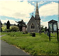
St Cynog's church Boughrood viewed from the east
The spire was installed in 2004, a replacement for the one demolished as unsafe in the 1970s. The rest of the church is mid-Victorian, built on the site of a medieval churchyard.
Image: © Jaggery Taken: 2 Jun 2013
0.22 miles
  • ...