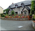
1
Road approaching Talgarth
Country road approaching Talgarth from the south-east.
Image: © Philip Halling
Taken: 2 Mar 2015
0.06 miles
2
View to Mynydd Troed
View to Mynydd Troed, a western outlying of the Black Mountains viewed from near Talgarth.
Image: © Philip Halling
Taken: 2 Mar 2015
0.06 miles
3
The Black Mountains from Talgarth
The northern escarp of the snow covered Black Mountains viewed from near the town of Talgarth.
Image: © Philip Halling
Taken: 3 Jan 2010
0.09 miles
4
Field outside Talgarth
Field outside Talgarth with Park Wood in the background
Image: © Philip Halling
Taken: 2 Mar 2015
0.12 miles
5
Tree-lined bank of the River Ennig, Talgarth
Viewed from an unnamed southern continuation of Heol Las and Regent Street.
The houses behind the trees are on Penbont Road.
Image: © Jaggery
Taken: 24 Jun 2012
0.13 miles
6
End of the roadway, Talgarth
An unnamed southern continuation of Heol Las and Regent Street ends at the gate ahead. Walkers can proceed by stepping over the low metal barrier on the right side of the gate. The word CLEAR is out of shot below KEEP.
This was formerly the A479, demoted to a side road after the opening of the modern A479. http://www.geograph.org.uk/photo/3010263
Image: © Jaggery
Taken: 24 Jun 2012
0.16 miles
7
Late summer flowers, Talgarth
There is a colourful mid August display in the front garden of this Penbont Road house.
Image: © Jaggery
Taken: 14 Aug 2011
0.17 miles
8
Unsuitable for HGVs and wide vehicles ahead on Penbont Road, Talgarth
Viewed from the Hospital Road junction.
Image: © Jaggery
Taken: 14 Aug 2011
0.17 miles
9
Lower Hospital Villas, Hospital Road, Talgarth
Viewed from the Penbont Road junction.
Image: © Jaggery
Taken: 14 Aug 2011
0.18 miles
10
A distant view of Mynydd Troed from the A479 near Talgarth
This view of the A479 along the long climb up from Talgarth shows the distant Mynydd Troed.
Image Its peak is 609 metres (almost 2,000 ft) above mean sea level. The view is from an elevation of about 150 metres or nearly 500 feet.
Image: © Jaggery
Taken: 24 Jun 2012
0.18 miles


