IMAGES TAKEN NEAR TO
Troed Y Bryn, BUILTH WELLS, LD2 3FE

Introduction

This page details the photographs taken nearby to Troed Y Bryn, LD2 3FE by members of the Geograph project.

The Geograph project started in 2005 with the aim of publishing, organising and preserving representative images for every square kilometre of Great Britain, Ireland and the Isle of Man.

There are currently over 7.5m images from over14,400 individuals and you can help contribute to the project by visiting https://www.geograph.org.uk

Image Map


Images are licensed for reuse under creativecommons.org/licenses/by-sa/2.0
Notes
  • Clicking on the map will re-center to the selected point.
  • The higher the marker number, the further away the image location is from the centre of the postcode.

Image Listing (410 Images Found)

Images are licensed for reuse under creativecommons.org/licenses/by-sa/2.0
  • ...
Image
Details
Distance
1
Tanhouse Bridge
Tanhouse Bridge over the Gloew Brook. Newry Road is part of the Wye Valley Walk. There is a stone on the bottom near left of the bridge, which was to stop carts damaging the bridge wall by forcing them away from the edge.
Image: © Phil Jones Taken: 10 Nov 2008
0.04 miles
2
Newry Road junction
The junction of Castle Road and Newry Road. The grey stone terraced was formerly Tanhouse Terrace. The old tannery is just visible at the top of the road.
Image: © Phil Jones Taken: 10 Nov 2008
0.04 miles
3
Newry Road, another view
Looking north along Newry Road on a damp and dismal day.
Image: © Phil Jones Taken: 10 Nov 2008
0.07 miles
4
Old Tannery
The Tannery ceased to operate many years ago, and was for a long time used by two local builders for workshops. It was converted to two dwellings.
Image: © Phil Jones Taken: 10 Nov 2008
0.07 miles
5
Scene on Newry Road, Builth Wells
Nice terraces here.
Image: © Jeremy Bolwell Taken: 3 Jul 2024
0.08 miles
6
Tannery House
This building was probably the owner/manager's house for the tannery (in background). Originally one house with a large door, the doorway has been amended and the building is now two dwellings.
Image: © Phil Jones Taken: 12 Oct 2008
0.08 miles
7
Across the castle
View towards where the Co-op is.
Image: © Bill Nicholls Taken: 25 Oct 2008
0.08 miles
8
Castle Road
I'm sure this is Castle Road but this is looking towards Market Street.
Image: © Bill Nicholls Taken: 25 Oct 2008
0.08 miles
9
Entrance to Eurospar, Builth Wells
Set back from the east side of Brecon Road, Eurospar Builth Wells is located in a former Co-op store. Eurospars are similar to the Spar stores in continental Europe. They are larger, and have a wider range of goods, than a standard Spar. Eurospars have a wide range of fresh food, with specialist counters such as bakery, butcher, fishmonger and delicatessen.
Image: © Jaggery Taken: 9 Jun 2013
0.09 miles
10
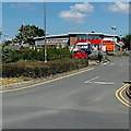
Access road to Eurospar, Builth Wells
Viewed from Brecon Road looking towards the Eurospar. http://www.geograph.org.uk/photo/3505223
Image: © Jaggery Taken: 9 Jun 2013
0.09 miles
  • ...