
IMAGES TAKEN NEAR TO
Hincaster, MILNTHORPE, LA7 7NF
Introduction
This page details the photographs taken nearby to LA7 7NF by members of the Geograph project.
The Geograph project started in 2005 with the aim of publishing, organising and preserving representative images for every square kilometre of Great Britain, Ireland and the Isle of Man.

There are currently over 7.5m images from over14,400 individuals and you can help contribute to the project by visiting https://www.geograph.org.uk
Image Map
Images are licensed for reuse under creativecommons.org/licenses/by-sa/2.0
Notes
- Clicking on the map will re-center to the selected point.
- The higher the marker number, the further away the image location is from the centre of the postcode.
Image Listing (18 Images Found)
Images are licensed for reuse under creativecommons.org/licenses/by-sa/2.0
Image
Details
Distance
1
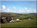
Viver near Hincaster
A small hamlet next to the busy A590 visible in the middle distance heading for the even busier M6. On the skyline are (right) Farleton Fell (265m) and Scout Hill (285m).
Image: © Karl and Ali
Taken: 19 Mar 2011
0.00 miles
2

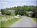
Viver Mill Farm
The farm entrance on Viver Lane displays a large millstone.
Image: © Mary and Angus Hogg
Taken: 6 Jun 2023
0.03 miles
4

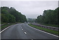
Stainton : A590
The A590 heading through the Stainton parish.
Image: © Lewis Clarke
Taken: 23 Sep 2019
0.06 miles
6
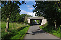
Road bridge, Viver
Carries the A590 eastern extension (Kendal - M6 link road, built in the mid 1970s) over a minor road.
Image: © Ian Taylor
Taken: 6 Sep 2018
0.08 miles
7

Stainton : A590
Heading along the A590.
Image: © Lewis Clarke
Taken: 27 Sep 2019
0.08 miles


10

Fields west of Viver Lane
On the slopes of West Viver Hill. The Helm http://www.geograph.org.uk/photo/1786819 is the prominent dark cone above the houses of Viver.
Image: © Karl and Ali
Taken: 19 Mar 2011
0.17 miles