IMAGES TAKEN NEAR TO
Shaw Lane, MILNTHORPE, LA7 7JD
Introduction
This page details the photographs taken nearby to Shaw Lane, LA7 7JD by members of the Geograph project.
The Geograph project started in 2005 with the aim of publishing, organising and preserving representative images for every square kilometre of Great Britain, Ireland and the Isle of Man.

There are currently over 7.5m images from over14,400 individuals and you can help contribute to the project by visiting https://www.geograph.org.uk
Image Map
Images are licensed for reuse under creativecommons.org/licenses/by-sa/2.0
Notes
- Clicking on the map will re-center to the selected point.
- The higher the marker number, the further away the image location is from the centre of the postcode.
Image Listing (16 Images Found)
Images are licensed for reuse under creativecommons.org/licenses/by-sa/2.0
Image
Details
Distance
1
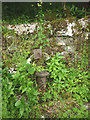
Old water pump by Throughs Lane, Storth
Defunct and overgrown. There is an overgrown wooden enclosure just north which was also a water source at one time.
Image: © Karl and Ali
Taken: 5 Jul 2015
0.05 miles
2

Old water pump by Throughs Lane, Storth (2)
A closer view of this derelict pump.
Image: © Karl and Ali
Taken: 9 Jul 2015
0.05 miles
3

Throughs Lane, Storth
The lane runs between rock walls, part of a fault-guided feature known elsewhere in the AONB as The Trough http://www.geograph.org.uk/photo/1601781
Image: © Karl and Ali
Taken: 28 Jan 2010
0.08 miles
5
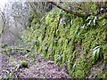
Rock wall on west side of Throughs Lane
This is part of the same geological feature that traverses the AONB seen here http://www.geograph.org.uk/photo/1601781 where it is called The Trough (cf Throughs Lane).
Image: © Karl and Ali
Taken: 28 Jan 2010
0.14 miles
6
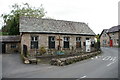
Mission Church of All Saints, Storth
Image: © Alexander P Kapp
Taken: 26 Sep 2005
0.15 miles
7
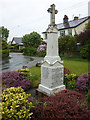
War memorial, Storth
A neat memorial in an immaculate little garden.
Image: © Karl and Ali
Taken: 27 May 2013
0.15 miles
8
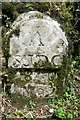
Old Boundary Marker by Cockshot Lane, Beetham Parish
Parish Boundary Marker by the UC road, in parish of Beetham (South Lakeland District), Cockshot Lane, opposite path to Hazelslack.
Surveyed
Milestone Society National ID: WE_ARNSJ02pb
Image: © Philip Platt
Taken: 5 Aug 2016
0.18 miles
9
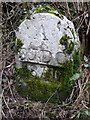
Boundary stone, Storth
This had me stumped but according to Tony Riden of the AONB Management Team "an ecclesiastic boundary marker stone for St James' Diocese Church, Arnside, hence: 'A StJDC 1870'. There is a map of this ecclesiastic boundary on a panel at St James' Church on Church Hill, Arnside (up the field footpath hill from the station)." Tony has forgotten more than most people know regarding all things local! Links to the church http://www.visitcumbria.com/churches/arnside.htm and http://www.geograph.org.uk/photo/629654
Image: © Karl and Ali
Taken: 28 Jan 2010
0.18 miles