
IMAGES TAKEN NEAR TO
Tarn Close, MILNTHORPE, LA7 7HZ
Introduction
This page details the photographs taken nearby to Tarn Close, LA7 7HZ by members of the Geograph project.
The Geograph project started in 2005 with the aim of publishing, organising and preserving representative images for every square kilometre of Great Britain, Ireland and the Isle of Man.

There are currently over 7.5m images from over14,400 individuals and you can help contribute to the project by visiting https://www.geograph.org.uk
Image Map
Images are licensed for reuse under creativecommons.org/licenses/by-sa/2.0
Notes
- Clicking on the map will re-center to the selected point.
- The higher the marker number, the further away the image location is from the centre of the postcode.
Image Listing (37 Images Found)
Images are licensed for reuse under creativecommons.org/licenses/by-sa/2.0
Image
Details
Distance
2
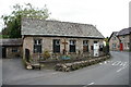
Mission Church of All Saints, Storth
Image: © Alexander P Kapp
Taken: 26 Sep 2005
0.04 miles
3
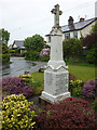
War memorial, Storth
A neat memorial in an immaculate little garden.
Image: © Karl and Ali
Taken: 27 May 2013
0.04 miles
4
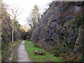
Sandside Cutting
Now a permissive path, the railway used to run from Arnside to the main west coast line near Hincaster. This rock cutting is quite an engineering feat.
Image: © Karl and Ali
Taken: 17 Dec 2009
0.11 miles
5
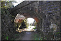
Green Lane bridge, Storth
Bridge over the old Arnside - Hincaster Junction railway line, now a footpath.
Image: © Ian Taylor
Taken: 2 Apr 2011
0.12 miles
6
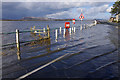
High water at Storth
The B5282, flooded by a spring tide (10.9m was predicted today).
Whitbarrow is across the Kent estuary.
Compare with Image (slightly lower tide).
Image: © Ian Taylor
Taken: 21 Feb 2015
0.14 miles
7
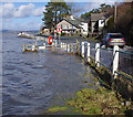
High water at Storth
The B5282, flooded by a spring tide (10.9m was predicted today), but passable if you don't mind washing the car with brackish water.
Compare with Image (tide out).
Image: © Ian Taylor
Taken: 21 Feb 2015
0.14 miles
8
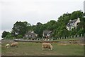
Sandside from the east bank of the River Kent
Sandside Road lies along the railings, while sheep graze on the salt marsh. St John's House stands (centre) at the junction with Green Lane.
Image: © Hugh Craddock
Taken: 7 Jun 2010
0.14 miles
9

Very High Tide at Arnside
This is one of the places on the road to Arnside where the high tide can come over the road, this was a day when the predicted height was above 10 metres and this was not quite high tide. If the road does flood there is an alternative route, although a good map is very handy. The vehicles just visible ahead have stopped because the road ahead was flooded.
Higher tide can be seen here https://www.geograph.org.uk/photo/4356301
Image: © Steve Houldsworth
Taken: 2 Mar 2010
0.15 miles
10
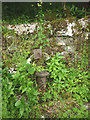
Old water pump by Throughs Lane, Storth
Defunct and overgrown. There is an overgrown wooden enclosure just north which was also a water source at one time.
Image: © Karl and Ali
Taken: 5 Jul 2015
0.15 miles