IMAGES TAKEN NEAR TO
Leighton Close, MILNTHORPE, LA7 7BG
Introduction
This page details the photographs taken nearby to Leighton Close, LA7 7BG by members of the Geograph project.
The Geograph project started in 2005 with the aim of publishing, organising and preserving representative images for every square kilometre of Great Britain, Ireland and the Isle of Man.

There are currently over 7.5m images from over14,400 individuals and you can help contribute to the project by visiting https://www.geograph.org.uk
Image Map
Images are licensed for reuse under creativecommons.org/licenses/by-sa/2.0
Notes
- Clicking on the map will re-center to the selected point.
- The higher the marker number, the further away the image location is from the centre of the postcode.
Image Listing (25 Images Found)
Images are licensed for reuse under creativecommons.org/licenses/by-sa/2.0
Image
Details
Distance
1
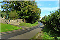
Towards Slack Head
Viewed from the edge of the square at the start of the new houses.
Image: © Mary and Angus Hogg
Taken: 15 Oct 2023
0.12 miles
2
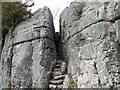
Fairy Steps
A geological feature of limestone pavement. If you can reach the top of the steps without touching the sides then your wish will be granted. You need to be thin as a rake and very agile!
Image: © John Berry
Taken: 5 Apr 2006
0.12 miles
3
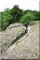
Whin Scar Cairn 171 Metres
I found a higher rib of raised ground following his directions then headed back east to path and found a largish cairn before joining the path a bit further south than I left it and lower than path high point. Either could be high point.
Name: Whin Scar
Hill number: 7701
Height: 117m / 384ft
Area: 34D: Southern Cumbria
Class: sHu
Grid ref: SD 48914 79002
Summit feature: tree
Drop: 93m
Col: 24m SD509771
Image: © Rude Health
Taken: 11 Nov 2011
0.16 miles
4

Fairy Steps
On the top of Whin Scar. The steps are in the cleft. No wishes granted today by the fairies as even my slim 8 year old daughter could not pass through without touching the sides.
Image: © Michael Graham
Taken: 4 Feb 2007
0.17 miles
5

Wall, High Cote
The limestone scar has been incorporated into the building of this dry stone wall.
Image: © Mick Garratt
Taken: 10 Mar 2007
0.18 miles
6

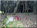
Carved inscriptions near Fairy Steps
South of the well-known cleft of Fairy Steps the limestone scar has been chiselled. The largest, most obvious inscription reads: 'W Hutton Beetham 1800'. Below it, with decreasing legibility, may be another Hutton from 1900 and possibly a third Hutton from 1925. Assuming they are not the same person it looks like a case of keeping it in the family. Googling turns up several 'W Huttons' of nearby Beetham, one of whom was the vicar http://www.northofthesands.org.uk/westmoreland/surname/114/hutton
Image: © Karl and Ali
Taken: 27 May 2013
0.18 miles
7

Top of the Fairy Steps in 1975
View of the top of the Fairy Steps in 1975.
Image: © Clint Mann
Taken: Unknown
0.19 miles

9

Fairy Steps in Underlaid Wood South Lakeland
Image: © Peter Robinson
Taken: 27 Jun 1997
0.19 miles