
IMAGES TAKEN NEAR TO
MILNTHORPE, LA7 7AH
Introduction
This page details the photographs taken nearby to LA7 7AH by members of the Geograph project.
The Geograph project started in 2005 with the aim of publishing, organising and preserving representative images for every square kilometre of Great Britain, Ireland and the Isle of Man.

There are currently over 7.5m images from over14,400 individuals and you can help contribute to the project by visiting https://www.geograph.org.uk
Image Map
Images are licensed for reuse under creativecommons.org/licenses/by-sa/2.0
Notes
- Clicking on the map will re-center to the selected point.
- The higher the marker number, the further away the image location is from the centre of the postcode.
Image Listing (24 Images Found)
Images are licensed for reuse under creativecommons.org/licenses/by-sa/2.0
Image
Details
Distance
5
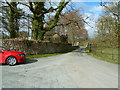
Road through The Deer Park at Dallam Tower
Image: © Alexander P Kapp
Taken: 18 Apr 2013
0.13 miles
6

Bracket fungus
This is Polyporus squamosus, Shaggy Dryad's Saddle, growing on the dead tree stump on the left in Image
Image: © Ian Taylor
Taken: 26 Nov 2016
0.13 miles
7
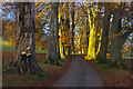
Dallam Park
The southern end of the road through the park passes down an avenue of trees. Here, some of the trees are lit by the low late autumn sun.
Image: © Ian Taylor
Taken: 26 Nov 2016
0.14 miles
8
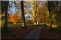
Dallam Park
The southern end of the road through the park passes down an avenue of trees. Here, some of the trees are lit by the low late autumn sun.
Image: © Ian Taylor
Taken: 26 Nov 2016
0.14 miles
9
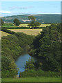
Tarn near Haverbrack
Just south of the hamlet is this considerable pond which is unnamed on the map. It sits in an enclosed depression which may be a solutional feature (there are several examples in the area such as Image and Image). On the other hand, it could be formed in a hollow between drumlins.
Image: © Karl and Ali
Taken: 25 Jul 2015
0.15 miles
10
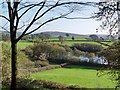
Small Lake at Haverbrack
With Farleton Fell in the background.
Image: © Bob Jenkins
Taken: 12 Nov 2009
0.15 miles