
IMAGES TAKEN NEAR TO
Bentham Road, CARNFORTH, LA6 3HZ
Introduction
This page details the photographs taken nearby to Bentham Road, LA6 3HZ by members of the Geograph project.
The Geograph project started in 2005 with the aim of publishing, organising and preserving representative images for every square kilometre of Great Britain, Ireland and the Isle of Man.

There are currently over 7.5m images from over14,400 individuals and you can help contribute to the project by visiting https://www.geograph.org.uk
Image Map
Images are licensed for reuse under creativecommons.org/licenses/by-sa/2.0
Notes
- Clicking on the map will re-center to the selected point.
- The higher the marker number, the further away the image location is from the centre of the postcode.
Image Listing (27 Images Found)
Images are licensed for reuse under creativecommons.org/licenses/by-sa/2.0
Image
Details
Distance
1

Benchmark on house at Clarrick House Farm
Ordnance Survey cut mark benchmark described on the Bench Mark Database at www.bench-marks.org.uk/bm89186
Image: © Roger Templeman
Taken: 5 Oct 2017
0.05 miles
2
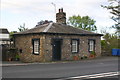
Toll Bar Cottage near south end of New Bridge
Image: © Roger Templeman
Taken: 5 Oct 2017
0.05 miles
3

Old tollhouse
Travelling northwestwards along the A65 towards Kirkby Lonsdale and Kendal the 'new' Ingleton tollhouse is at the approach to New Bridge over the River Greta. This replaced the tollhouse in Ingleton village centre, long since demolished, which was on the line of the original Keighley/Kendal turnpike. The route which the A65 now takes was developed in the mid 19thC and this tollhouse dates from about 1840. It is made of slobbered rubble with painted stone dressings and a slate hipped roof. It has 18 pane casements and a central ridge stack. It is Grade II listed.
Image: © Chris Minto
Taken: 14 Aug 2024
0.05 miles
4
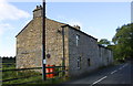
Clarrick House Farm buildings, Bentham Road
There is an Ordnance Survey benchmark Image on the near corner, road face, of the house.
Image: © Roger Templeman
Taken: 5 Oct 2017
0.07 miles

6

New Bridge taking New Road (A65) over River Greta
There is an OS benchmark Image on the stone parapet at its junction with the near end of the right hand metal parapet
Image: © Roger Templeman
Taken: 5 Oct 2017
0.08 miles
7

New Bridge, Ingleton
Carries the A65 over the River Greta, bypassing the village centre.
Built in 1933 to replace the previous stone arch bridge, which was closed in 1929. The damage to the old bridge was probably due to mining subsidence, but this was not proved. The colliery closed a few years later.
Image: © Ian Taylor
Taken: 1 Jan 2013
0.09 miles
8

The New Bridge, Ingleton
This carries the A65 and has speeded up through traffic enormously.
Image: © Bill Boaden
Taken: 27 Aug 2010
0.09 miles
9

River Greta at Ingleton
The River Greta is a tributary of the River Lune. It is formed by the confluence of the River Twiss and the River Doe at Ingleton. From Ingleton, the Greta travels westwards through Burton-in-Lonsdale and, over the border in Lancashire, before flowing into the Lune.
Image: © David Dixon
Taken: 13 Nov 2017
0.10 miles
