
IMAGES TAKEN NEAR TO
New Village, CARNFORTH, LA6 3DQ
Introduction
This page details the photographs taken nearby to New Village, LA6 3DQ by members of the Geograph project.
The Geograph project started in 2005 with the aim of publishing, organising and preserving representative images for every square kilometre of Great Britain, Ireland and the Isle of Man.

There are currently over 7.5m images from over14,400 individuals and you can help contribute to the project by visiting https://www.geograph.org.uk
Image Map
Images are licensed for reuse under creativecommons.org/licenses/by-sa/2.0
Notes
- Clicking on the map will re-center to the selected point.
- The higher the marker number, the further away the image location is from the centre of the postcode.
Image Listing (18 Images Found)
Images are licensed for reuse under creativecommons.org/licenses/by-sa/2.0
Image
Details
Distance
1

Fellsman Hike start, Ingleton School 1978
Several hundred competitors starting the 17th annual Fellsman Hike, bound for their first checkpoint on the summit of Ingleborough.
Image: © Jim Barton
Taken: 20 May 1978
0.12 miles
2

The A65 through Ingleton
The A65 road passes through the southern part of the town.
Image: © SIMON PHILLIPS
Taken: 3 Sep 2005
0.13 miles
3

Footbridge over Jenkin Beck
The path carries a public footpath from Greenwood Leghe to Ingleton.
Image: © Stephen Craven
Taken: 27 Aug 2017
0.13 miles
4

Coal mining memorial, Ingleton
Across the A65 from the last mine at Ingleton - Ingleton New Colliery. See Image for a wider view.
The plaque states -
Erected in 2004
To commemorate the contribution made to the community by the Ingleton coal mining industry for over 300 years until its closure in 1936.
Image: © Ian Taylor
Taken: 1 Jan 2013
0.14 miles
5

Coal mining memorial, Ingleton
The last mine at Ingleton - Ingleton New Colliery - was on the right, across the A65.
See Image for a closer view.
Image: © Ian Taylor
Taken: 1 Jan 2013
0.14 miles

7

Scrap yard at junction of Rarber Top Lane and New Road
Ordnance Survey records indicate that in 1970 a benchmark levelled at 126.168m above Newlyn Datum was verified on a wall here. The road name sign appears to have misspelt Rarber
Image: © Roger Templeman
Taken: 5 Oct 2017
0.14 miles
8

Route of old railway outside Ingleton
Looking north-west along the railway route where it crossed Jenkin Beck.
Image: © Stephen Craven
Taken: 27 Aug 2017
0.15 miles

10
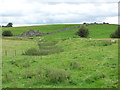
Old railway embankment below Yarlsber
Old maps show an inclined plane mineral tramway running down the hillside, the connecting via this curved embankment to a siding off the main railway line outside Ingleton at roughly the photographer position here.
Image: © Stephen Craven
Taken: 27 Aug 2017
0.17 miles