
IMAGES TAKEN NEAR TO
Kirkby Lonsdale, CARNFORTH, LA6 2HJ
Introduction
This page details the photographs taken nearby to LA6 2HJ by members of the Geograph project.
The Geograph project started in 2005 with the aim of publishing, organising and preserving representative images for every square kilometre of Great Britain, Ireland and the Isle of Man.

There are currently over 7.5m images from over14,400 individuals and you can help contribute to the project by visiting https://www.geograph.org.uk
Image Map
Images are licensed for reuse under creativecommons.org/licenses/by-sa/2.0
Notes
- Clicking on the map will re-center to the selected point.
- The higher the marker number, the further away the image location is from the centre of the postcode.
Image Listing (108 Images Found)
Images are licensed for reuse under creativecommons.org/licenses/by-sa/2.0
Image
Details
Distance
1
![Queen Elizabeth School [3]](https://s3.geograph.org.uk/geophotos/06/26/94/6269443_058e6a57_120x120.jpg)
Queen Elizabeth School [3]
The gable end of the original schoolroom with the inscription 'Free Grammar School'. The schoolroom was built in the 1840s when the school was moved to the present site. Listed, grade II, with details at: https://historicengland.org.uk/listing/the-list/list-entry/1318927
The school was founded by royal charter in 1591. For other views of the school see Image and Image
Image: © Michael Dibb
Taken: 28 Jun 2019
0.02 miles
2
![Queen Elizabeth School [2]](https://s2.geograph.org.uk/geophotos/06/26/94/6269442_5deb2477_120x120.jpg)
Queen Elizabeth School [2]
The original schoolroom.
Built in the 1840s and incorporating a central stone panel brought from the original site in Mill Brow. Listed, grade II, with details at: https://historicengland.org.uk/listing/the-list/list-entry/1318927
The school was founded by royal charter in 1591 and moved to the present site in the 1840s. For other views of the school see Image and Image
Image: © Michael Dibb
Taken: 28 Jun 2019
0.02 miles
3
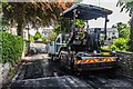
Biggins Road
Resurfacing Biggins Road.
Image: © Peter McDermott
Taken: 31 May 2017
0.04 miles
4
![Queen Elizabeth School [1]](https://s1.geograph.org.uk/geophotos/06/26/94/6269441_3df21837_120x120.jpg)
Queen Elizabeth School [1]
A general view of the school.
Founded by royal charter in 1591 and moved to the present site in the 1840s. The original schoolroom remains as part of the school - see Image and Image
Image: © Michael Dibb
Taken: 28 Jun 2019
0.05 miles
5
![Kirkby Lonsdale houses [60]](https://s3.geograph.org.uk/geophotos/06/26/85/6268507_45d60811_120x120.jpg)
Kirkby Lonsdale houses [60]
This 18th or early 19th century house is named Tollgate Cottage. Previously an inn, known at various times as the Fencing Boys, the Cross Keys and the Rose Tree. Listed, grade II, as Rose Tree Cottage with details at: https://historicengland.org.uk/listing/the-list/list-entry/1138306
Kirkby Lonsdale is a small town that developed at a crossing of the River Lune. Granted a market charter in 1227, the town at one time had 29 inns and alehouses of which several survive. The town is rich in historic buildings with over 150 listed.
Image: © Michael Dibb
Taken: 28 Jun 2019
0.06 miles
6
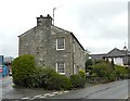
Tollhouse by the B6446, Kendal Road, Kirkby Lonsdale
Tollhouse by the B6446, in the parish of Kirkby Lonsdale (South Lakeland District), Tollgate Cottage, Kendal Road, at the junction with Biggins Road, LA6 2DL.
Grade II listed.
List Entry Number: 1138306 https://historicengland.org.uk/listing/the-list/list-entry/1138306
Surveyed
Milestone Society National ID: CB.KLO
Image: © Alan Rosevear
Taken: 11 May 2012
0.08 miles
8

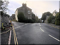
Queen Elizabeth School
Playing fields at Queen Elizabeth School.
Image: © Peter McDermott
Taken: 31 May 2017
0.09 miles
9

St Mary's Church of England primary school, Kirkby Lonsdale
School roll (2017): 232.
Image: © Bill Harrison
Taken: 30 Aug 2018
0.10 miles
10
![Kirkby Lonsdale houses [59]](https://s2.geograph.org.uk/geophotos/06/26/85/6268502_cef951b4_120x120.jpg)
Kirkby Lonsdale houses [59]
Abbot Hall was built in 1632 and had been altered in both the 18th and 19th centuries. The right part is older and was a thatched farmhouse until the mid 20th century. Many 17th and 18th century internal features survive. Listed, grade II, with details at: https://historicengland.org.uk/listing/the-list/list-entry/1311673
Kirkby Lonsdale is a small town that developed at a crossing of the River Lune. Granted a market charter in 1227, the town at one time had 29 inns and alehouses of which several survive. The town is rich in historic buildings with over 150 listed.
Image: © Michael Dibb
Taken: 28 Jun 2019
0.12 miles