
IMAGES TAKEN NEAR TO
Main Street, CARNFORTH, LA6 2AQ
Introduction
This page details the photographs taken nearby to Main Street, LA6 2AQ by members of the Geograph project.
The Geograph project started in 2005 with the aim of publishing, organising and preserving representative images for every square kilometre of Great Britain, Ireland and the Isle of Man.

There are currently over 7.5m images from over14,400 individuals and you can help contribute to the project by visiting https://www.geograph.org.uk
Image Map
Images are licensed for reuse under creativecommons.org/licenses/by-sa/2.0
Notes
- Clicking on the map will re-center to the selected point.
- The higher the marker number, the further away the image location is from the centre of the postcode.
Image Listing (582 Images Found)
Images are licensed for reuse under creativecommons.org/licenses/by-sa/2.0
Image
Details
Distance
1
![Kirkby Lonsdale buildings [35]](https://s0.geograph.org.uk/geophotos/06/26/48/6264816_d7404a59_120x120.jpg)
Kirkby Lonsdale buildings [35]
Numbers 19, nearest the camera, and 17, are a pair of early 19th century shops. Number 19 has had the shop front removed. Number 17 has had a door blocked. Listed, grade II, with details at: https://historicengland.org.uk/listing/the-list/list-entry/1146433
Kirkby Lonsdale is a small town that developed at a crossing of the River Lune. Granted a market charter in 1227, the town at one time had 29 inns and alehouses of which several survive. The town is rich in historic buildings with over 150 listed.
Image: © Michael Dibb
Taken: 28 Jun 2019
0.01 miles
2

Main Street, Kirkby Lonsdale
Around the corner is the market square with its distinctive cross.
Image: © Jim Barton
Taken: 10 Aug 2016
0.01 miles
3
![Kirkby Lonsdale buildings [36]](https://s1.geograph.org.uk/geophotos/06/26/48/6264821_d68f534a_120x120.jpg)
Kirkby Lonsdale buildings [36]
Numbers 13, nearest the camera, and 11 are a pair of early 19th century shops both retaining the original shopfronts. No longer used as shops the buildings are listed, grade II, with details at: https://historicengland.org.uk/listing/the-list/list-entry/1145790
Kirkby Lonsdale is a small town that developed at a crossing of the River Lune. Granted a market charter in 1227, the town at one time had 29 inns and alehouses of which several survive. The town is rich in historic buildings with over 150 listed.
Image: © Michael Dibb
Taken: 28 Jun 2019
0.01 miles
4
![Kirkby Lonsdale buildings [34]](https://s0.geograph.org.uk/geophotos/06/26/48/6264812_fc829640_120x120.jpg)
Kirkby Lonsdale buildings [34]
Numbers 23, nearest the camera, and 21 Main Street are a pair of early 19th century shops. Number 21 has had the shop front removed. Note the central windows above the doors are blind with painted glazing bars. Listed, grade II, with details at: https://historicengland.org.uk/listing/the-list/list-entry/1145791
Kirkby Lonsdale is a small town that developed at a crossing of the River Lune. Granted a market charter in 1227, the town at one time had 29 inns and alehouses of which several survive. The town is rich in historic buildings with over 150 listed.
Image: © Michael Dibb
Taken: 28 Jun 2019
0.01 miles
5
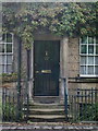
Town End House, Main Street, Kirkby Lonsdale, Doorway
Image: © Alexander P Kapp
Taken: 16 Jul 2008
0.01 miles
6
![Kirkby Lonsdale houses [40]](https://s1.geograph.org.uk/geophotos/06/26/48/6264829_14c5a8dc_120x120.jpg)
Kirkby Lonsdale houses [40]
Number 9 Main Street has its main facade, seen here, facing south. Built in the late 18th or early 19th century in fine ashlar with some attractive window features. The mid 19th century extension to the right has an elliptical arched recess sheltering outside stone stair to first floor entry. The carriage entrance with elliptical arched head is now blocked. The house and the garden wall and gate piers at the rear (see Image) are listed, grade II, with details at: https://historicengland.org.uk/listing/the-list/list-entry/1146420
Kirkby Lonsdale is a small town that developed at a crossing of the River Lune. Granted a market charter in 1227, the town at one time had 29 inns and alehouses of which several survive. The town is rich in historic buildings with over 150 listed.
Image: © Michael Dibb
Taken: 28 Jun 2019
0.01 miles
7
![Kirkby Lonsdale houses [41]](https://s1.geograph.org.uk/geophotos/06/26/48/6264833_2d7ed9cb_120x120.jpg)
Kirkby Lonsdale houses [41]
The rear facade, seen here, of number 9 Main Street has two staircase windows carried from near ground level to cornice level. Built in the late 18th or early 19th century in fine ashlar with some attractive window features. For the main, south facing facade see Image The house and the garden wall and gate piers at the rear are listed, grade II, with details at: https://historicengland.org.uk/listing/the-list/list-entry/1146420
Kirkby Lonsdale is a small town that developed at a crossing of the River Lune. Granted a market charter in 1227, the town at one time had 29 inns and alehouses of which several survive. The town is rich in historic buildings with over 150 listed.
Image: © Michael Dibb
Taken: 28 Jun 2019
0.01 miles
8

Off Main Street, Kirkby Lonsdale
The blue is part of the archway in Gallery Court
Image: © Alexander P Kapp
Taken: 16 Jul 2008
0.02 miles
10
![Kirkby Lonsdale houses [45]](https://s3.geograph.org.uk/geophotos/06/26/55/6265515_54cd822d_120x120.jpg)
Kirkby Lonsdale houses [45]
Number 10 Main Street is early 19th century with a central doorway and a passage on the right. Listed, grade II, with details at: https://historicengland.org.uk/listing/the-list/list-entry/1311895
Kirkby Lonsdale is a small town that developed at a crossing of the River Lune. Granted a market charter in 1227, the town at one time had 29 inns and alehouses of which several survive. The town is rich in historic buildings with over 150 listed.
Image: © Michael Dibb
Taken: 28 Jun 2019
0.02 miles