
IMAGES TAKEN NEAR TO
Morewood Drive, CARNFORTH, LA6 1NE
Introduction
This page details the photographs taken nearby to Morewood Drive, LA6 1NE by members of the Geograph project.
The Geograph project started in 2005 with the aim of publishing, organising and preserving representative images for every square kilometre of Great Britain, Ireland and the Isle of Man.

There are currently over 7.5m images from over14,400 individuals and you can help contribute to the project by visiting https://www.geograph.org.uk
Image Map
Images are licensed for reuse under creativecommons.org/licenses/by-sa/2.0
Notes
- Clicking on the map will re-center to the selected point.
- The higher the marker number, the further away the image location is from the centre of the postcode.
Image Listing (73 Images Found)
Images are licensed for reuse under creativecommons.org/licenses/by-sa/2.0
Image
Details
Distance
1
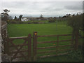
Footpath on the east edge of Burton-in-Kendal
Image: © Karl and Ali
Taken: 6 Apr 2014
0.06 miles
2

Burton-in-Kendal, primary school
Morewood School, at the corner of Main Street and Morewood Drive. http://www.webmountain.co.uk/index.php?school=0002
Image: © Mike Faherty
Taken: 12 May 2012
0.08 miles
3
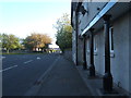
A6070 through Burton-in-Kendal
The village school is beyond the junction on the left. The over-hanging first-floor supported by pillars is a feature of several blocks of housing here.
Image: © Barbara Carr
Taken: 30 Apr 2011
0.10 miles

6

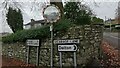
Burton-in-Kendal Memorial Hall
On Main Street: http://www.burtonweb.org.uk/viewpage.php?page_id=7
Image: © Mike Faherty
Taken: 13 May 2012
0.14 miles
8
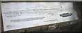
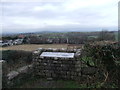
Panoramic viewpoint, Burton-in-Kendal
The inscribed metal plate showing the view at Image
Image: © Karl and Ali
Taken: 6 Apr 2014
0.14 miles
9

Golden Jubilee viewpoint, Burton-in-Kendal
This viewpoint at the southern end of the Slape Lane bridleway was erected by Burton-in-Kendal parish council to honour the Queen's Golden Jubilee of 2002. The metal plate Image depicts numerous Lakeland fells, none of which were visible today - note rain approaching! The nearby parish church is visible with the distinctive dome of Arnside Knott above and left.
Image: © Karl and Ali
Taken: 6 Apr 2014
0.14 miles
10
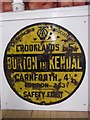
Old circular AA Sign in the Memorial Hall, Burton in Kendal
Old AA Sign located inside the Memorial Hall on the west side of the A6070 in Burton in Kendal, 10 miles north of Lancaster. Burton in Kendal parish.
This is the circular, village name on black band, no Motor Union symbol or name type, dating from 1923 and showing distances Crooklands 5 Carnforth 4¼ London 243¼.
There were five series of AA signs, mostly dating from 1923 and made by Francis & Co / Franco in Deptford, London. The village name and distance to London were displayed.
Milestone Society National ID: CB-BURT
Image: © Milestone Society
Taken: Unknown
0.14 miles