
IMAGES TAKEN NEAR TO
Bridge Road, CARNFORTH, LA6 1HH
Introduction
This page details the photographs taken nearby to Bridge Road, LA6 1HH by members of the Geograph project.
The Geograph project started in 2005 with the aim of publishing, organising and preserving representative images for every square kilometre of Great Britain, Ireland and the Isle of Man.

There are currently over 7.5m images from over14,400 individuals and you can help contribute to the project by visiting https://www.geograph.org.uk
Image Map
Images are licensed for reuse under creativecommons.org/licenses/by-sa/2.0
Notes
- Clicking on the map will re-center to the selected point.
- The higher the marker number, the further away the image location is from the centre of the postcode.
Image Listing (41 Images Found)
Images are licensed for reuse under creativecommons.org/licenses/by-sa/2.0
Image
Details
Distance
1
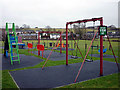
Play area, Nether Kellet
All the under-15s were probably on their X-boxes today? It was a bit damp.
Image: © Karl and Ali
Taken: 6 Feb 2011
0.07 miles

3

Water tankers, Nether Kellet
A pair of tankers are used to provide an emergency water supply whilst a leak at Over Kellet is repaired.
Image: © Ian Taylor
Taken: 17 Jul 2018
0.07 miles
5
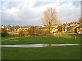
Nether Kellet Village Green
Looking NW across a soggy green. This part of the green is still used for grazing.
Image: © Ian Taylor
Taken: 6 Dec 2009
0.09 miles
6

Nether Kellet Village Green
Looking SW towards the village hall. This part of the green has a football pitch.
Image: © Ian Taylor
Taken: 6 Dec 2009
0.09 miles
7
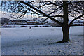
Nether Kellet Village Green
Snow rarely lingers hereabouts, so there is little time to build a snowman. The couple of inches that fell this afternoon was no exception.
Image: © Ian Taylor
Taken: 1 Mar 2015
0.10 miles
8

St Mark's Church, Nether Kellet
Built in 1879, according to Pevsner. The plain side window seems odd for a church of that date; perhaps it also served as a school.
Image: © Humphrey Bolton
Taken: 21 Dec 2007
0.11 miles
9
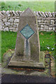
Nether Kellet Peace Stone
Erected to commemorate the end of the Second World War, in which 16 villagers served without loss of life. The plaque reads -
"This tribute to a lasting peace was planted by T.C. Butler-Cole, Esq of Tunstall House and Mrs. S.T. Whalan of this village at the Nether Kellet peace celebrations on the 8th Sept. 1945 to commemorate the cessation of hostilities in the 2nd World War 3rd Sept. 1939 - 15th Aug. 1945."
Nether Kellet is also one of the "Thankful Villages" which did not lose any men in the First World War. See http://www.hellfirecorner.co.uk/thankful.htm .
Image: © Ian Taylor
Taken: 7 May 2011
0.12 miles
10
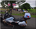
The Thankful Villages Run
A group of motorcyclists visited Nether Kellet on their tour of the 51 "Thankful Villages" which did not lose any men in the First World War. The Triumph Trophy motorcycle was supplied by the manufacturer for the tour. See http://www.thankfulvillagesrun.com/index.php.
In the background, a short ceremony is being held at the Peace Stone (see Image), when the village was presented with a plaque.
(Keen-eyed observers may notice that the motorcycle is fitted with a camera holder for mass-collection of geograph points.)
Image: © Ian Taylor
Taken: 3 Aug 2013
0.13 miles