
IMAGES TAKEN NEAR TO
Electric Drive, CARNFORTH, LA6 1FW
Introduction
This page details the photographs taken nearby to Electric Drive, LA6 1FW by members of the Geograph project.
The Geograph project started in 2005 with the aim of publishing, organising and preserving representative images for every square kilometre of Great Britain, Ireland and the Isle of Man.

There are currently over 7.5m images from over14,400 individuals and you can help contribute to the project by visiting https://www.geograph.org.uk
Image Map
Images are licensed for reuse under creativecommons.org/licenses/by-sa/2.0
Notes
- Clicking on the map will re-center to the selected point.
- The higher the marker number, the further away the image location is from the centre of the postcode.
Image Listing (52 Images Found)
Images are licensed for reuse under creativecommons.org/licenses/by-sa/2.0
Image
Details
Distance
1

Construction site by M6 Junction 35
Construction of a car showroom and workshop continues. Compare with Image, taken 12 weeks earlier.
Image: © Ian Taylor
Taken: 25 Oct 2020
0.01 miles
2

Construction site by M6 Junction 35
Construction of a car showroom and workshop has started on this greenfield site, sandwiched between the M6 and the Junction 35 link road. The permanent access to this site will be from the A601(M) link road, which will need to be downgraded from a motorway. A cluster of new business developments is forming here.
Image: © Ian Taylor
Taken: 3 Aug 2020
0.05 miles

4
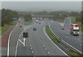
Junction 35 of the M6 motorway at Carnforth
Image: © Mat Fascione
Taken: 18 Sep 2018
0.08 miles
5

The start of the A601(M)
The A601(M) has two parts - the part west of Junction 35 with the M6 is a dual carriageway link to the A6, and once formed the northern end of the M6 until the main motorway was extended northwards. But the eastern part was added in 1987 to enable lorries from the quarries to the south to join the M6 without having to go through Carnforth. Its potential usage didn't justify a full blown dual carriageway, but because it gave nowhere to go for non-motorway traffic, it had to be designated a motorway. The result: a stretch of single carriageway motorway, with two way traffic, which ends at a T junction with a B road (the B6254), as shown here! Note the motorway and two way traffic signs.
Not as impressive in length as what was the A6144(M) in Greater Manchester (Image), which is also single carriageway but alas is now no longer a motorway, despite what the map for the square still shows (and unfortunately there are no photos of it on Geograph), but the A601(M) is still a worthy feature of the UK road network. In particular, being a motorway without speed limit indications, it presumably has a 70mph speed limit - one of the few places in the country where one can legally travel at 70mph on a non-dual carriageway, not that the stretch of road is really long enough to allow it!
Image: © Ian Capper
Taken: 12 Apr 2008
0.08 miles

7

Fields at Approaches to junction 35 on the M6
Approach sign can just be seen on right
Image: © John Firth
Taken: 9 May 2011
0.08 miles
8

M6 northbound, Carnforth
Looking north east from the bridge on Kellet Road towards Junction 35.
Image: © JThomas
Taken: 14 Jul 2018
0.08 miles
9

Construction of Carnforth Business Park
Erection of the first four units (01 - 04) is in progress. Compare with Image
Image: © Ian Taylor
Taken: 15 Jan 2012
0.09 miles
10

Construction of Carnforth Business Park
Erection of the first unit (03) is in progress. See Image for a more general view.
The foundations for unit 01 have been laid in the foreground.
Image: © Ian Taylor
Taken: 4 Dec 2011
0.09 miles