
IMAGES TAKEN NEAR TO
Hall Garth Gardens, CARNFORTH, LA6 1BY
Introduction
This page details the photographs taken nearby to Hall Garth Gardens, LA6 1BY by members of the Geograph project.
The Geograph project started in 2005 with the aim of publishing, organising and preserving representative images for every square kilometre of Great Britain, Ireland and the Isle of Man.

There are currently over 7.5m images from over14,400 individuals and you can help contribute to the project by visiting https://www.geograph.org.uk
Image Map
Images are licensed for reuse under creativecommons.org/licenses/by-sa/2.0
Notes
- Clicking on the map will re-center to the selected point.
- The higher the marker number, the further away the image location is from the centre of the postcode.
Image Listing (59 Images Found)
Images are licensed for reuse under creativecommons.org/licenses/by-sa/2.0
Image
Details
Distance
2

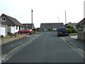
Over Kellet village green
Looking down Borwick Lane / Capernwray Road.
Image: © Ian Taylor
Taken: 7 Apr 2008
0.05 miles
3

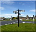
Kellet Lane Junction, Over Kellet
The roads lead to Borwick, as signed, and to Capernwray, both pretty Lancashire villages.
Image: © David Medcalf
Taken: 9 Oct 2005
0.08 miles
4

Hall Garth, Over Kellet
Overlooking the north western corner of the village green in Over Kellet.
Country house dating back to 1826, in stuccoed limestone with a hipped slate roof.
Grade II Listed.
Image: © Chris Heaton
Taken: 8 Mar 2026
0.09 miles
5
Crossroads, Over Kellet
At the village green.
Image: © philandju
Taken: 29 Jun 2015
0.09 miles
6

Over Kellet village green
Over Kellet village green and war memorial.
Image: © Colin Kinnear
Taken: 24 Jul 2020
0.09 miles
8
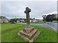
Old Wayside Cross
Kellet Cross, a Central Cross with an old shaft, base and steps in a new cross. Set on the village green on the southeast side of the junction of the B6254 Kirkby Lonsdale Road and Nether Kellet Road in Over Kellet parish. Grade II Listed https://historicengland.org.uk/listing/the-list/list-entry/1071868. See also http://www.geograph.org.uk/photo/3262410 and http://www.geograph.org.uk/photo/2057741.
Milestone Society National ID: LALA_OVE
Image: © D Phillips
Taken: Unknown
0.10 miles

10
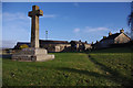
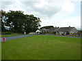
Over Kellet village green
Showing the village cross. A path has been worn on the right - the shortest route between Kirkby Lonsdale Road and the Post Office.
Image: © Ian Taylor
Taken: 16 Dec 2012
0.10 miles