
IMAGES TAKEN NEAR TO
Bolton Le Sands, CARNFORTH, LA5 9TN
Introduction
This page details the photographs taken nearby to LA5 9TN by members of the Geograph project.
The Geograph project started in 2005 with the aim of publishing, organising and preserving representative images for every square kilometre of Great Britain, Ireland and the Isle of Man.

There are currently over 7.5m images from over14,400 individuals and you can help contribute to the project by visiting https://www.geograph.org.uk
Image Map
Images are licensed for reuse under creativecommons.org/licenses/by-sa/2.0
Notes
- Clicking on the map will re-center to the selected point.
- The higher the marker number, the further away the image location is from the centre of the postcode.
Image Listing (33 Images Found)
Images are licensed for reuse under creativecommons.org/licenses/by-sa/2.0
Image
Details
Distance
1
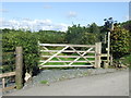
Gate near Bolton-le-Sands
A gate and stile leading onto a public footpath near Bolton-le-Sands, Lancashire. A public footpath sign is just visible on a wooden post to the right of the stile.
Image: © Malc McDonald
Taken: 26 Aug 2012
0.05 miles
2

Lane near Bolton-le-Sands
A lane in the Lancashire countryside near Bolton-le-Sands.
Image: © Malc McDonald
Taken: 26 Aug 2012
0.06 miles

4
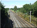
West Coast main line near Carnforth
This railway is part of the West Coast Main Line, linking London, the West Midlands and North West England with Glasgow. The line is electrified using overhead cables.
Image: © Malc McDonald
Taken: 26 Aug 2012
0.08 miles
5
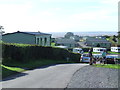
Bay View Holiday Park, Morecambe Bay
Bay View Holiday Park is a camping and caravanning centre near Bolton-le-Sands, overlooking Morecambe Bay.
Image: © Malc McDonald
Taken: 26 Aug 2012
0.09 miles

7

Old Milestone by the A6, Main Road, Bolton-le-Sands
Metal plate attached to stone post by the A6, in parish of BOLTON LE SANDS (LANCASTER District), Main Road, on northern edge of Bolton, 210m North of junction with Hawthorn Road, where road approaches the edge of the railway cutting, behind crash barrier on grass bank leading down to hedge beside railway, on West side of road. Lancaster twin iron plate, erected by the Garstang & Heronsyke turnpike trust in the 19th century.
Inscription reads:-
: BURTON / V½ / MILES : : BOLTON : : LANCASTER / V / MILES :
Carved benchmark and rivet on top.
Grade II listed.
List Entry Number: 1071939 https://historicengland.org.uk/listing/the-list/list-entry/1071939
Milestone Society National ID: LA_LABK05
Image: © A Rosevear
Taken: 16 Jul 2003
0.15 miles
8

Lancaster Canal
Bridge 126 showing the reinforcements on the east side bank. This section is above road level and has received much attention in the past due to leakage.
Image: © Arnold Price
Taken: 3 Apr 2012
0.16 miles
9
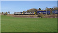
Freight train, Bolton-le-Sands
A pair of Freightliner Class 90 electric locomotives haul a down intermodal container train (Daventry to Coatbridge) on the West Coast Main Line.
Image: © Ian Taylor
Taken: 25 Mar 2019
0.16 miles
10

The Lancaster Canal at Bolton le Sands
Image: © Raymond Knapman
Taken: 13 Aug 2012
0.17 miles