
IMAGES TAKEN NEAR TO
Keats Avenue, CARNFORTH, LA5 8HH
Introduction
This page details the photographs taken nearby to Keats Avenue, LA5 8HH by members of the Geograph project.
The Geograph project started in 2005 with the aim of publishing, organising and preserving representative images for every square kilometre of Great Britain, Ireland and the Isle of Man.

There are currently over 7.5m images from over14,400 individuals and you can help contribute to the project by visiting https://www.geograph.org.uk
Image Map
Images are licensed for reuse under creativecommons.org/licenses/by-sa/2.0
Notes
- Clicking on the map will re-center to the selected point.
- The higher the marker number, the further away the image location is from the centre of the postcode.
Image Listing (42 Images Found)
Images are licensed for reuse under creativecommons.org/licenses/by-sa/2.0
Image
Details
Distance
1

St Michael's Lane
Where the West Coast Main Line crosses St Michael's Lane at Bolton-le-Sands.
Image: © David Dixon
Taken: 4 Jul 2024
0.15 miles
2

Bolton-le-Sands Station, with Down Express
View SW, towards Lancaster, Preston and the South; Lancaster - Carlisle section of ex-LNW West Coast Main Line. Station closed 3/2/69. The express is the 16.35 Liverpool (Exchange) to Glasgow (Central), hauled by a splendid Stanier 'Jubilee' class 4-6-0, No. 45717 'Dauntless' (built 7/36 and withdrawn 10/63 after working its last 15 years from Bank Hall (Liverpool)).
Image: © Ben Brooksbank
Taken: 10 Sep 1962
0.16 miles
3

Level Crossing At Bolton-le-Sands
This is where the main west coast line crosses St Michael's Lane. Trains can pass here at very high speeds.
Image: © Mary and Angus Hogg
Taken: 16 Feb 2019
0.16 miles

5

Heading south on the A6
Towards the seafront at Morecambe.
Image: © James Denham
Taken: 23 Jun 2014
0.16 miles
6

Village scene, Bolton-le-Sands
View to the north end of Main Street where it joins the main A6. Warton Crag in the background.
Image: © Andrew Hill
Taken: 31 Oct 2012
0.17 miles
7

West Coast Main Line, Bolton-le-Sands
Looking towards Carnforth from the level crossing at the site of Bolton-le-Sands station.
The station was demolished after closure in 1969 and before electrification was completed in 1974.
The station had already disappeared on the 1971 one-inch map, but was still open on the 1996 1:25000 OL41 map!
A footbridge remained here for many years after closure of the station. It is still shown on current maps, but had disappeared by 2003 (Google Earth).
See Ben Brooksbank's photo Image for the reverse view in 1962.
Image: © Ian Taylor
Taken: 11 May 2010
0.17 miles
8

Tesco express at Bolton-le-Sands
Direct Rail Services are now using new class 88 electro-diesels on this Daventry to Mossend intermodal container service. Previously, the train was normally hauled by a pair of class 68 or 66 diesels (see Image).
The Stadler Rail (formerly Vossloh) UKDual class 88 shares many components with the class 68 diesel but has a higher power output in electric mode. The lower power diesel mode allows it to operate in unelectrified sidings (the "last mile").
The class 88 locos are the first new electric locos to appear on the British network for over 20 years, and the first 25kV ac electro-diesels.
Image: © Ian Taylor
Taken: 26 Jun 2017
0.17 miles
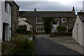
10

Bolton-le-Sands Cricket Club
Have 2 Teams in the Westmorland League
Image: © Gordon Cann
Taken: 26 Jun 2010
0.18 miles