IMAGES TAKEN NEAR TO
Silverdale, CARNFORTH, LA5 0UA
Introduction
This page details the photographs taken nearby to LA5 0UA by members of the Geograph project.
The Geograph project started in 2005 with the aim of publishing, organising and preserving representative images for every square kilometre of Great Britain, Ireland and the Isle of Man.

There are currently over 7.5m images from over14,400 individuals and you can help contribute to the project by visiting https://www.geograph.org.uk
Image Map
Images are licensed for reuse under creativecommons.org/licenses/by-sa/2.0
Notes
- Clicking on the map will re-center to the selected point.
- The higher the marker number, the further away the image location is from the centre of the postcode.
Image Listing (169 Images Found)
Images are licensed for reuse under creativecommons.org/licenses/by-sa/2.0
Image
Details
Distance


3

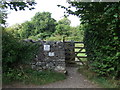
The top entrance gate to Jack Scout NT
Heathy headland overlooking Morecambe Bay.
Image: © Peter Turner
Taken: 3 Apr 2011
0.08 miles

5

Gate, access point onto Jack Scout off Lindeth Lane
http://www.citycoastcountryside.co.uk/site/silverdale-jenny-browns-point-and-jack-scout-p16215
Image: © Alexander P Kapp
Taken: 17 Dec 2008
0.09 miles

7

Lane heading south
Towards Jenny Brown's Point.
Image: © JThomas
Taken: 26 Sep 2015
0.12 miles
8

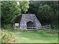
Jack Scout Limekiln
The lime was spread on the fields to "sweeten" the soil by helping the release of nitrogen from manure.
Image: © Bob Jenkins
Taken: 21 Jan 2010
0.13 miles