
IMAGES TAKEN NEAR TO
Birch Grove, CARNFORTH, LA5 0BQ
Introduction
This page details the photographs taken nearby to Birch Grove, LA5 0BQ by members of the Geograph project.
The Geograph project started in 2005 with the aim of publishing, organising and preserving representative images for every square kilometre of Great Britain, Ireland and the Isle of Man.

There are currently over 7.5m images from over14,400 individuals and you can help contribute to the project by visiting https://www.geograph.org.uk
Image Map
Images are licensed for reuse under creativecommons.org/licenses/by-sa/2.0
Notes
- Clicking on the map will re-center to the selected point.
- The higher the marker number, the further away the image location is from the centre of the postcode.
Image Listing (43 Images Found)
Images are licensed for reuse under creativecommons.org/licenses/by-sa/2.0
Image
Details
Distance
1
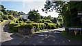
Far Close Drive
Far Close Drive off New Barns Road in Arnside.
Image: © Peter McDermott
Taken: 19 Sep 2015
0.05 miles
4
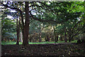
Grubbins Wood, Arnside
A local nature reserve, with a high proportion of yew and birch trees.
Image: © Ian Taylor
Taken: 7 Oct 2012
0.12 miles
5

Victorian postbox, New Barns Road, Arnside
Image: © Karl and Ali
Taken: 4 Jan 2014
0.13 miles
6
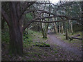
Footpath in Grubbins Wood, Arnside
The woodland is a Cumbria Wildlife Trust reserve, open to the general public.
Image: © Karl and Ali
Taken: 3 Jan 2018
0.14 miles
7
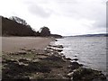
Along the Kent Estuary
Looking west down the Estuary, near Arnside. Across the other side, in the distance is Grange over Sands
Image: © Chris Heaton
Taken: 18 Apr 2006
0.15 miles
8

New Barns Road
New Barns Road in Arnside.
Image: © Peter McDermott
Taken: 19 Sep 2015
0.15 miles
9

Morecambe Bay
At Grubbins Wood near Arnside.
Image: © philandju
Taken: 29 Jun 2015
0.17 miles
10

Beside the River Kent at low tide
These limestone rocks beside the estuary have been smoothed by a glacier advancing out of the Lake District.
Image: © Karl and Ali
Taken: 12 May 2011
0.18 miles