
IMAGES TAKEN NEAR TO
Silverdale Road, CARNFORTH, LA5 0AH
Introduction
This page details the photographs taken nearby to Silverdale Road, LA5 0AH by members of the Geograph project.
The Geograph project started in 2005 with the aim of publishing, organising and preserving representative images for every square kilometre of Great Britain, Ireland and the Isle of Man.

There are currently over 7.5m images from over14,400 individuals and you can help contribute to the project by visiting https://www.geograph.org.uk
Image Map
Images are licensed for reuse under creativecommons.org/licenses/by-sa/2.0
Notes
- Clicking on the map will re-center to the selected point.
- The higher the marker number, the further away the image location is from the centre of the postcode.
Image Listing (182 Images Found)
Images are licensed for reuse under creativecommons.org/licenses/by-sa/2.0
Image
Details
Distance
1

Information board, Ashmeadow Woodlands, Arnside
'The John Barnes Charitable Trust welcomes you to these woodland grounds'.
Image: © Karl and Ali
Taken: 13 Jan 2013
0.08 miles
2

Folly/tower, Arnside
An impressive folly/tower with mock battlements made from rough chunks of weathered limestone. Set beside a public footpath along a narrow ginnel.
Image: © Karl and Ali
Taken: 21 Feb 2016
0.08 miles

4

The Albion, Arnside
The Albion occupies a prominent position in this small town on the Kent estuary. There were no takers for the outside seating on this dull and dreary Christmas Eve, however.
Image: © Stephen McKay
Taken: 24 Dec 2008
0.09 miles
5

Arnside and the Kent Viaduct from the air
The viaduct crosses the River Kent between Grange-Over-Sands and Arnside. Viewed from a Brussels bound flight from Prestwick.
Image: © Thomas Nugent
Taken: 1 Mar 2010
0.09 miles
6

The Albion, Arnside
Situated on the seafront, with great views across Morecambe Bay, this pub has recently been refurbished and has an outdoor area at the front which is a good place to sit and watch the world go by on a nice sunny day. The Albion is a Thwaites house. For a view of the sign see Image
Image: © Maigheach-gheal
Taken: 22 Mar 2010
0.10 miles
7
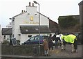
Drinking with horses outside The Albion, Arnside
Image: © Karl and Ali
Taken: 13 Jan 2013
0.10 miles
8

Sign for the Albion
Albion is a poetic name for Britain, probably based on Latin albus 'white', with reference to the whiteness of the southern coastal cliffs. Many ships have been named Albion.
Image: © Maigheach-gheal
Taken: 22 Mar 2010
0.10 miles
9
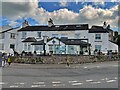
The Albion
Public house & restaurant in Arnside
Image: © Graham Hogg
Taken: 8 Aug 2023
0.10 miles
10

Old Direction Sign - Signpost by Red Hills Road, Arnside
Ball finial - 2 arms; by the UC road, in parish of Arnside (South Lakeland District), at junction of Silverdale Road with Red Hills Road, on pavement, against stone wall.
To be surveyed
Milestone Society National ID: WE_SD4578A
Image: © Milestone Society
Taken: Unknown
0.10 miles