
IMAGES TAKEN NEAR TO
Akeman Close, MORECAMBE, LA3 3BP
Introduction
This page details the photographs taken nearby to Akeman Close, LA3 3BP by members of the Geograph project.
The Geograph project started in 2005 with the aim of publishing, organising and preserving representative images for every square kilometre of Great Britain, Ireland and the Isle of Man.

There are currently over 7.5m images from over14,400 individuals and you can help contribute to the project by visiting https://www.geograph.org.uk
Image Map
Images are licensed for reuse under creativecommons.org/licenses/by-sa/2.0
Notes
- Clicking on the map will re-center to the selected point.
- The higher the marker number, the further away the image location is from the centre of the postcode.
Image Listing (31 Images Found)
Images are licensed for reuse under creativecommons.org/licenses/by-sa/2.0
Image
Details
Distance
1
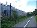
Pilgrims Way signpost
On the Greenway, alongside White Lund Trading Estate.
Image: © Christine Johnstone
Taken: 10 Oct 2013
0.02 miles
2
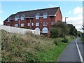
Three-storey houses in Akeman Court
Alongside the Greenway, a former railway line.
Image: © Christine Johnstone
Taken: 10 Oct 2013
0.02 miles
3

Lancaster-Morecambe Greenway
A cycle route occupying the route of a former railway, dividing White Lund Industrial Estate on the left from new housing development on the right.
Image: © Bill Boaden
Taken: 28 Feb 2014
0.04 miles
4

Exit to Hadrian Road
One of the many access routes to/from the Sustrans route between Lancaster and Morecambe which make it so popular. Behind the fence is the White Lund industrial estate on the site of a former rubbish tip.
Image: © Stephen Craven
Taken: 9 Jun 2018
0.07 miles
5
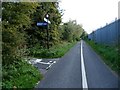
Foss Court signpost
Looking south-east on the Greenway, a former railway line.
Image: © Christine Johnstone
Taken: 10 Oct 2013
0.07 miles
6

Houses at the west end of Hadrian Road
A newish development at the end of an older road.
Image: © Christine Johnstone
Taken: 10 Oct 2013
0.07 miles
7
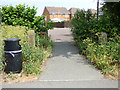
Exit to Hadrian Road - old gateposts
The gateposts obviously predate both the housing estate and the cycle track. Old maps show a farm track crossing the railway line at this point.
Image: © Stephen Craven
Taken: 9 Jun 2018
0.07 miles
8
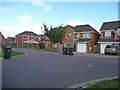
Bin day in Foss Court
A side road off Hadrian Road - they all seem to be named after Roman roads.
Image: © Christine Johnstone
Taken: 10 Oct 2013
0.07 miles
9
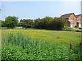
Meadow at the end of Hadrian Road
This reminds me a bit of my childhood - not in this area, but living near the end of a dead-end road that led into a farmer's field.
Image: © Stephen Craven
Taken: 9 Jun 2018
0.09 miles
10

Grazing land near Torrisholme
The developer of the houses to the right apparently also wanted to buy this land, but was refused.
Image: © Bill Boaden
Taken: 28 Feb 2014
0.10 miles