
IMAGES TAKEN NEAR TO
Balmoral Road, MORECAMBE, LA3 1HP
Introduction
This page details the photographs taken nearby to Balmoral Road, LA3 1HP by members of the Geograph project.
The Geograph project started in 2005 with the aim of publishing, organising and preserving representative images for every square kilometre of Great Britain, Ireland and the Isle of Man.

There are currently over 7.5m images from over14,400 individuals and you can help contribute to the project by visiting https://www.geograph.org.uk
Image Map
Images are licensed for reuse under creativecommons.org/licenses/by-sa/2.0
Notes
- Clicking on the map will re-center to the selected point.
- The higher the marker number, the further away the image location is from the centre of the postcode.
Image Listing (37 Images Found)
Images are licensed for reuse under creativecommons.org/licenses/by-sa/2.0
Image
Details
Distance
1

South west end of Balmoral Road, Sandylands
Looking across Fairfield Road from St John's Grove.
Image: © Richard Vince
Taken: 17 Jun 2017
0.03 miles
2

St Patrick's Catholic Church, Morecambe. Interior
Image: © Alexander P Kapp
Taken: 23 Sep 2008
0.08 miles
3
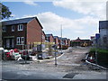
New houses off St John's Road, Morecambe
Image: © Alexander P Kapp
Taken: 23 Sep 2008
0.09 miles
4
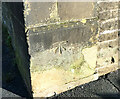
OS Bench Mark
OS cut bench mark from the 19th century levelling, on corner of schoolyard wall on Hampton Road. 21.0 feet above old datum.
Image: © Phil Johnstone
Taken: 23 Nov 2021
0.09 miles
5

St. Patrick's RC Church, Heysham
The church being demolished in September 2007
See also Image
Image: © Simon Harmsworth
Taken: 26 Sep 2007
0.09 miles
6
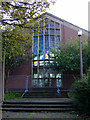
St. Patrick's RC Church, Heysham
This photo was taken in September 2007 as the church was being demolished to make way for low-cost housing. See also Image
Image: © Simon Harmsworth
Taken: 26 Sep 2007
0.09 miles
7

St John's Grove, Sandylands (2)
Approaching the bend about halfway along.
Image: © Richard Vince
Taken: 17 Jun 2017
0.09 miles
8

St Patrick's Catholic Church, Morecambe
Image: © Alexander P Kapp
Taken: 23 Sep 2008
0.10 miles
9
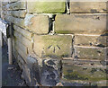
OS Bench Mark
OS cut bench mark from the 19th century levelling, on garden wall of No.40 Fairfield Road. 25.0 feet above old datum.
Image: © Phil Johnstone
Taken: 23 Nov 2021
0.10 miles
10
St John's Grove, Sandylands (1)
Climbing towards St John's Avenue (left) from St John's Road.
Image: © Richard Vince
Taken: 17 Jun 2017
0.12 miles