IMAGES TAKEN NEAR TO
Abbeystead, LANCASTER, LA2 9BH
Introduction
This page details the photographs taken nearby to LA2 9BH by members of the Geograph project.
The Geograph project started in 2005 with the aim of publishing, organising and preserving representative images for every square kilometre of Great Britain, Ireland and the Isle of Man.

There are currently over 7.5m images from over14,400 individuals and you can help contribute to the project by visiting https://www.geograph.org.uk
Image Map
Images are licensed for reuse under creativecommons.org/licenses/by-sa/2.0
Notes
- Clicking on the map will re-center to the selected point.
- The higher the marker number, the further away the image location is from the centre of the postcode.
Image Listing (46 Images Found)
Images are licensed for reuse under creativecommons.org/licenses/by-sa/2.0
Image
Details
Distance
1
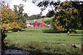
House at Abbeystead
Viewed from across the Tarnbrook Wyre
Image: © Tom Richardson
Taken: 26 Sep 1999
0.01 miles
2

Abbeystead house, Bowland
This is the Duke of Westminster's Shooting Lodge
Image: © David Medcalf
Taken: 31 May 2005
0.04 miles
3
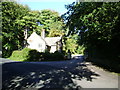
Lancaster Lodge
The Lodge at the entrance to Abbeystead House
Image: © Alexander P Kapp
Taken: 5 Sep 2007
0.05 miles
4
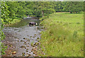
Cow crossing Tarnbrook Wyre
She slowly picked her way across, under the belief that the grass is greener on the other side.
Image: © Mr T
Taken: 18 Jul 2007
0.07 miles
5
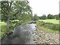
River Tarnbrook Wyre
Looking upstream. A short way upstream from its confluence with the Marshaw Wyre.
Image: © Oliver Dixon
Taken: 1 Aug 2021
0.08 miles
6
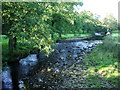
Tarnbrook Wyre
Looking upstream from Stoops Bridge
Image: © Alexander P Kapp
Taken: 5 Sep 2007
0.08 miles
7
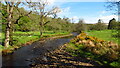
Tarnbrook Wyre as seen from Stoops Bridge, Abbeystead
Image: © Richard Park
Taken: 18 May 2021
0.09 miles
8

Tarnbook Wyre in Abbeystead
This looks upstream, showing the last scene of the Tarnbrook Wyre before it merges with the Marshaw Wyre to form just one river - namely the Wyre
Image: © Chris Heaton
Taken: 29 Apr 2024
0.09 miles
9

Track heading for Lower Lee
Pleasant track squeezed between Larpet Wood and the Tarbrook Wyre River.
Image: © Chris Heaton
Taken: 29 Apr 2024
0.10 miles