
IMAGES TAKEN NEAR TO
Clapham, LANCASTER, LA2 8JD
Introduction
This page details the photographs taken nearby to LA2 8JD by members of the Geograph project.
The Geograph project started in 2005 with the aim of publishing, organising and preserving representative images for every square kilometre of Great Britain, Ireland and the Isle of Man.

There are currently over 7.5m images from over14,400 individuals and you can help contribute to the project by visiting https://www.geograph.org.uk
Image Map
Images are licensed for reuse under creativecommons.org/licenses/by-sa/2.0
Notes
- Clicking on the map will re-center to the selected point.
- The higher the marker number, the further away the image location is from the centre of the postcode.
Image Listing (23 Images Found)
Images are licensed for reuse under creativecommons.org/licenses/by-sa/2.0
Image
Details
Distance

2
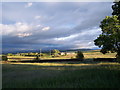
Tewit Hall from Goat Gap
Tewit hall, with the Northern edge of the Forest of Bowland in the background, from Goat Gap.
Image: © Mike Green
Taken: 25 Jun 2007
0.03 miles
3
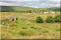
Tewit Hall
The goat sheds at Tewit Hall, which is a farm with a very large number of goats farmed for milk. The foreground is a bridge over the dismantled railway line.
Image: © Mike Green
Taken: 12 Jul 2009
0.05 miles

5

Old milestone
A close-up of the now very rusty West Riding CC milestone first set up in 1893/94. Close inspection reveals WILLIAM TOWLER/GLOBE FOUNDRY/LEEDS on the bevel. The mileage to Keighley, 33, is hidden by rust and grass. This style of milestone was set up by the newly formed County Council some years after the Keighley, Skipton and Kirby in Kendal turnpike trust ended in the early 1870s.
Image: © Hilary Jones
Taken: 29 Jun 2022
0.14 miles
6

Old milestone
This West Riding CC milestone is west of Clapham almost opposite Goat Gap. It was once well painted but exposure to the weather and closeness to the tarmac of the A65 have taken its toll.
Image: © H
Taken: 29 Jun 2022
0.14 miles
7

Clapham cum Newby milestone
Milestone on the South of the A65 at the end of the bridge over a watercourse labelled 'Newby Moor Bridge' on the OS map. The end of the bridge is visible in this image, it being a substantial, stone construction over a very boggy areas of ground taking water from the side of Grey Scars.
Image: © Mike Green
Taken: 12 Jul 2009
0.14 miles
8

Old Milestone, on the A65, W of Clapham
Located on the South side of road, nearly opp Goat Gap. Metal plate attached to stone post, WR casting design, erected by Keighley & Kendal turnpike trust, 19th century. Alternative view see https://www.geograph.org.uk/photo/1396973
Inscription reads: KENDAL / 21 MILES // SETTLE / 8¼ MILES / SKIPTON 23¾ MILES / KEIGHLEY / 33 MILES // KEIGHLEY & KENDAL / ROAD / CLAPHAM / CUM / NEWBY // WILLIAM TOWLER / GLOBE FOUNDRY / - LEEDS -
Milestone Society National ID: YN_KEKN33
Image: © Christine Minto
Taken: 31 Dec 2005
0.14 miles
9

Road junction near Goat Gap
The road from Clapham station joins the A65 here near Goat gap
Image: © William Bartlett
Taken: 5 Nov 2006
0.16 miles
10

Ordnance Survey Flush Bracket 11383
This can be found on Newby Moor Bridge.
For more detail see : http://www.bench-marks.org.uk/bm22054
Image: © Peter Wood
Taken: 20 Jun 2014
0.16 miles