
IMAGES TAKEN NEAR TO
Robin Lane, LANCASTER, LA2 7AG
Introduction
This page details the photographs taken nearby to Robin Lane, LA2 7AG by members of the Geograph project.
The Geograph project started in 2005 with the aim of publishing, organising and preserving representative images for every square kilometre of Great Britain, Ireland and the Isle of Man.

There are currently over 7.5m images from over14,400 individuals and you can help contribute to the project by visiting https://www.geograph.org.uk
Image Map
Images are licensed for reuse under creativecommons.org/licenses/by-sa/2.0
Notes
- Clicking on the map will re-center to the selected point.
- The higher the marker number, the further away the image location is from the centre of the postcode.
Image Listing (10 Images Found)
Images are licensed for reuse under creativecommons.org/licenses/by-sa/2.0
Image
Details
Distance
1

Public footpath to Bankhead Farm and beyond
Running west from High Bentham's Robin Lane. Bankhead Farm is the building in the distance.
Image: © Christine Johnstone
Taken: 22 Feb 2018
0.04 miles
2

Semi-detached houses, Lakeber Drive, High Bentham
Early 20th century houses on the northern edge of a small market town.
Image: © Christine Johnstone
Taken: 22 Feb 2018
0.11 miles
3

Houses at the junction of Banks Way and Lakeber Drive
At the northern edge of High Bentham - a small market town.
Image: © Christine Johnstone
Taken: 22 Feb 2018
0.18 miles
4

Telecoms mast, off Robin Lane
On the northern edge of High Bentham.
Image: © Christine Johnstone
Taken: 22 Feb 2018
0.18 miles
5
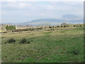
Rough grassland, Bentham Golf Course
On the north-west periphery of the course, next to Robin Lane. On the horizon, about 6 kms away, Ingleborough.
Image: © Christine Johnstone
Taken: 22 Feb 2018
0.21 miles

7

Benchmark, Butterbur Cottage
Detail of the Ordnance Survey cut benchmark on the north-west corner of Butterbur Cottage. The benchmark marks a height of 115.0533m above sea level (Ordnance Datum Newlyn) last verified in 1970 (location photograph Image).
Image: © Adrian Taylor
Taken: 22 Apr 2022
0.23 miles
8

Butterbur Cottage
There is an Ordnance Survey cut benchmark on the northwest corner of Butterbur Cottage, facing Robin Lane (photograph Image).
Image: © Adrian Taylor
Taken: 22 Apr 2022
0.23 miles
9

Robin Lane and Butterbur Cottage, High Bentham
Looking along Robin Lane with Butterbur Cottage on the right. There is an Ordnance Survey bench mark on the far corner of the cottage next to the road - Image
Image: © John S Turner
Taken: 31 Aug 2011
0.24 miles
10

Bench mark on Butterbur Cottage, High Bentham
This Ordnance Survey bench mark is on the north west corner of Butterbur Cottage, Robin Lane, High Bentham. See also Image
Image: © John S Turner
Taken: 31 Aug 2011
0.24 miles