
IMAGES TAKEN NEAR TO
Kirkstone Road, AMBLESIDE, LA22 9EL
Introduction
This page details the photographs taken nearby to Kirkstone Road, LA22 9EL by members of the Geograph project.
The Geograph project started in 2005 with the aim of publishing, organising and preserving representative images for every square kilometre of Great Britain, Ireland and the Isle of Man.

There are currently over 7.5m images from over14,400 individuals and you can help contribute to the project by visiting https://www.geograph.org.uk
Image Map
Images are licensed for reuse under creativecommons.org/licenses/by-sa/2.0
Notes
- Clicking on the map will re-center to the selected point.
- The higher the marker number, the further away the image location is from the centre of the postcode.
Image Listing (435 Images Found)
Images are licensed for reuse under creativecommons.org/licenses/by-sa/2.0
Image
Details
Distance

2

Sign advising that The Struggle is closed
This is the road from Ambleside up to the Kirkstone Pass. Despite the sign, it wasn't closed. Wansfell Pike is behind.
Image: © Bill Boaden
Taken: 14 Mar 2011
0.03 miles

4

Victorian postbox, Kirkstone Road, Ambleside
Image: © Karl and Ali
Taken: 23 Nov 2013
0.05 miles
5

Heading out to Kirkstone Road
From The Falls heading out to Kirkstone Road
Image: © Shaun Ferguson
Taken: 18 Jun 2016
0.06 miles
6

Ambleside and Loughrigg
Photo taken from a public footpath off Kirkstone Road leading to Snarker Pike and on to Red Screes.
Image: © Peter S
Taken: 20 Jun 2013
0.09 miles

8
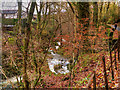
Stock Ghyll, Above Ambleside
Looking down from Stockghyll Lane.
Image: © David Dixon
Taken: 19 Nov 2015
0.09 miles

10

Former chapel on Kirkstone Road
Now converted into a family home
Image: © Eirian Evans
Taken: 13 Oct 2018
0.09 miles