
IMAGES TAKEN NEAR TO
CONISTON, LA21 8HE
Introduction
This page details the photographs taken nearby to LA21 8HE by members of the Geograph project.
The Geograph project started in 2005 with the aim of publishing, organising and preserving representative images for every square kilometre of Great Britain, Ireland and the Isle of Man.

There are currently over 7.5m images from over14,400 individuals and you can help contribute to the project by visiting https://www.geograph.org.uk
Image Map
Images are licensed for reuse under creativecommons.org/licenses/by-sa/2.0
Notes
- Clicking on the map will re-center to the selected point.
- The higher the marker number, the further away the image location is from the centre of the postcode.
Image Listing (48 Images Found)
Images are licensed for reuse under creativecommons.org/licenses/by-sa/2.0
Image
Details
Distance
1

Fairsnape Cottage, Coniston
Fairsnape Cottage is an extended 17th century cottage located close to the centre of Coniston Village. The gardens here are beautiful and the views to Coniston Water are magnificent.
http://www.coppermines.co.uk/property/show_details.cgi?id=21
Image: © Graham
Taken: Unknown
0.01 miles
2

Bridge over dismantled railway, Coniston
Image: © Ian Taylor
Taken: 17 Apr 2019
0.06 miles
3

Bramble Cottage, Coniston
Bramble Cottage is one of a terrace of traditional miners cottages built overlooking Coniston Village and Coniston Water.
http://www.coppermines.co.uk/property/show_details.cgi?id=86
Image: © Graham
Taken: Unknown
0.09 miles
4

Bank Terrace, Coniston
A row of cottages built of Lakeland Stone with a grandstand view overlooking the village of Coniston
Image: © Chris Heaton
Taken: 12 Aug 2013
0.09 miles
5

Chapel Bank House, Coniston
Built in 1859 the old Methodist Chapel on the south side of Coniston Village has been converted into a unique holiday cottage with views to Coniston Water
http://www.coppermines.co.uk/property/show_details.cgi?id=136
Image: © Graham
Taken: Unknown
0.10 miles

7

Ordnance Survey Cut Mark
This OS cut mark can be found on Gateside House. It marks a point 60.692m above mean sea level.
Image: © Adrian Dust
Taken: 12 Feb 2018
0.13 miles


10
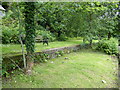
Coniston slate wharf
Slate from quarries in the area was the principal freight traffic from Coniston. It was loaded onto railway wagons from the slate wharf situated directly opposite the station entrance.
Image: © Adrian Taylor
Taken: 8 Jul 2020
0.18 miles