IMAGES TAKEN NEAR TO
Haws Bank, CONISTON, LA21 8AR
Introduction
This page details the photographs taken nearby to LA21 8AR by members of the Geograph project.
The Geograph project started in 2005 with the aim of publishing, organising and preserving representative images for every square kilometre of Great Britain, Ireland and the Isle of Man.

There are currently over 7.5m images from over14,400 individuals and you can help contribute to the project by visiting https://www.geograph.org.uk
Image Map
Images are licensed for reuse under creativecommons.org/licenses/by-sa/2.0
Notes
- Clicking on the map will re-center to the selected point.
- The higher the marker number, the further away the image location is from the centre of the postcode.
Image Listing (32 Images Found)
Images are licensed for reuse under creativecommons.org/licenses/by-sa/2.0
Image
Details
Distance
1
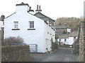
Haws Bank Cottage
17th Century Grade II listed building
Image: © Ed Conduit
Taken: 22 Jul 2018
0.04 miles
2
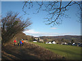
On the disused railway approaching Haws Bank
The railway used to run from Foxfield to Coniston but parts of it are now used as a permissive footpath and cycle route. The RC church in the photo is at the far end of Haws Bank off the main road leading into Coniston, with Bowmanstead the next named place, home of The Ship pub.
Image: © Karl and Ali
Taken: 1 Feb 2015
0.09 miles
3
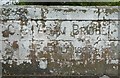
Old Bridge Marker by the A593, Adam Bridge, Bowmanstead
Bridge Marker by the A593, in parish of Coniston (South Lakeland District), Adam Bridge, Bowmanstead, bridge parapet on the West side.
Inscription reads:- : C.C. ADAM BRIDGE / REBUILT 1899 :
Surveyed
Milestone Society National ID: LA_CONI01br.
Image: © Milestone Society
Taken: Unknown
0.09 miles
4
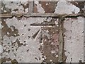
Benchmark, Adam Bridge
Detail of the Ordnance Survey cut benchmark in the sandstone parapet of Adam Bridge, marking a height of 74.6135m above sea level (Ordnance Datum) last levelled and verified in 1969 (location photograph Image).
Image: © Adrian Taylor
Taken: 4 Jul 2019
0.10 miles
5
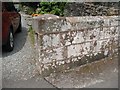
Bridge parapet with benchmark
Adam Bridge on the A593 was rebuilt by Lancashire County Council in 1899 with dressed sandstone parapets. The western parapet has an Ordnance Survey cut benchmark marking a height of 74.6135m above sea level (Ordnance Datum Newlyn) last levelled and verified in 1969 (photograph Image).
Image: © Adrian Taylor
Taken: 4 Jul 2019
0.10 miles
6
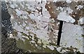
Ordnance Survey Cut Mark
This OS cut mark can be found on the west parapet of Adam Bridge. It marks a point 74.6135m above mean sea level.
Image: © Adrian Dust
Taken: 12 Feb 2018
0.10 miles
7
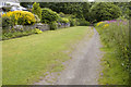
Footpath past Spoon Hall
The path is along the line of the old railway
Image: © Tom Richardson
Taken: 5 Jul 2011
0.10 miles