
IMAGES TAKEN NEAR TO
Chapel Street, LANCASTER, LA2 0JP
Introduction
This page details the photographs taken nearby to Chapel Street, LA2 0JP by members of the Geograph project.
The Geograph project started in 2005 with the aim of publishing, organising and preserving representative images for every square kilometre of Great Britain, Ireland and the Isle of Man.

There are currently over 7.5m images from over14,400 individuals and you can help contribute to the project by visiting https://www.geograph.org.uk
Image Map
Images are licensed for reuse under creativecommons.org/licenses/by-sa/2.0
Notes
- Clicking on the map will re-center to the selected point.
- The higher the marker number, the further away the image location is from the centre of the postcode.
Image Listing (60 Images Found)
Images are licensed for reuse under creativecommons.org/licenses/by-sa/2.0
Image
Details
Distance

2

Ordnance Survey Flush Bracket G2798
This bracket can be found on the wall of St Josephs Church.
For more detail see : http://www.bench-marks.org.uk/bm10741
Image: © Peter Wood
Taken: 4 Aug 2012
0.03 miles
3

Preston Lancaster Road at Galgate village boundary
Image: © Colin Pyle
Taken: 16 Feb 2013
0.06 miles
4

Old Milestone by the A6, Main Road, Galgate
Stone post (plates lost) by the A6, in parish of ELLEL (LANCASTER District), Main Road, Galgate, opposite No. 35, beside Car sales lot, in pavement between tubular steel barriers, on West side of road. Lancaster twin iron plate, erected by the Garstang & Heronsyke turnpike trust in the 19th century.
Inscription once read:-
: (LANCASTER / IV / MILES) : : (GARSTANG / VI¾ / MILES) : : ELLEL :
Milestone Society National ID: LA_LAGS04.
Image: © A Rosevear
Taken: 16 Jul 2003
0.06 miles
5

OS Bench Mark
OS cut bench mark on parapet of bridge over River Conder. 22.061 m above datum.
Image: © Phil Johnstone
Taken: 21 Sep 2021
0.07 miles
6

Galgate, beck
Looking upstream, with Galgate Mill in the distance.
Image: © Mike Faherty
Taken: 16 May 2012
0.07 miles
7
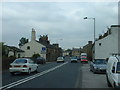
A6 in Galgate
The construction cranes at Lancaster University are visible in the distance
Image: © David Medcalf
Taken: 23 Jul 2005
0.07 miles
8

Galgate Silk Mills
This view shows three stages of building - The original 18C mill is on the left, partly obscured by garages and sheds. According to Nikolaus Pevsner, this was started in 1792 and was the first silk spinning mill in England. The stone buildings next to the road, in the middle distance, came next, and then the tall red-brick block, built in 1852. The chimney shows that this was powered by a steam engine. Note the water tank, painted dull green, on top of the corner of the building.
Image: © Humphrey Bolton
Taken: 25 Dec 2009
0.08 miles
9

Galgate
Viewed from a train on the West Coast Main Line.
Image: © Thomas Nugent
Taken: 17 Jul 2017
0.08 miles
10

Old Village Signpost by the A6, Lancaster Road, Galgate
Turret finial - 1 arm; Lancs village entry sign by the A6, in parish of Lancaster (Lancaster District), North of Galgate, 100m North of turn to the mills and Ellel, in hedge, East side of road.
Surveyed
Milestone Society National ID: LA_SD4855
Image: © Milestone Society
Taken: Unknown
0.09 miles