
IMAGES TAKEN NEAR TO
Broughton Mills, BROUGHTON-IN-FURNESS, LA20 6AZ
Introduction
This page details the photographs taken nearby to LA20 6AZ by members of the Geograph project.
The Geograph project started in 2005 with the aim of publishing, organising and preserving representative images for every square kilometre of Great Britain, Ireland and the Isle of Man.

There are currently over 7.5m images from over14,400 individuals and you can help contribute to the project by visiting https://www.geograph.org.uk
Image Map
Images are licensed for reuse under creativecommons.org/licenses/by-sa/2.0
Notes
- Clicking on the map will re-center to the selected point.
- The higher the marker number, the further away the image location is from the centre of the postcode.
Image Listing (11 Images Found)
Images are licensed for reuse under creativecommons.org/licenses/by-sa/2.0
Image
Details
Distance
1

'You'll never walk alone' at Knott End
I felt touched by this sign of civilization in the heart of the wilderness.
Image: © Karl and Ali
Taken: 14 Jul 2012
0.02 miles
2

Heading to Knott End
The footpath to the road passes through the farmyard and by this magnificent Monkey Puzzle tree.
Image: © Karl and Ali
Taken: 14 Jul 2012
0.02 miles
3

Public footpath and access road to Knott End
Image: © Rob Noble
Taken: 24 Aug 2013
0.08 miles
4

Stile and Footpath
Leads to Scrithwaite Farm crossing Dunnerdale Beck
Image: © Michael Graham
Taken: 17 Mar 2007
0.10 miles
5

Ford across Dunnerdale Beck
A farm track fords the beck. For pedestrians, there is a clapper bridge just to the left of this. See Image
Image: © Rob Noble
Taken: 24 Aug 2013
0.10 miles

7

Minor road in Dunnerdale
The road is heading north, passing close to the farm at Knott End
Image: © Trevor Littlewood
Taken: 3 Sep 2017
0.11 miles


10
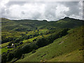
Dunnerdale from The Knott
Dry Hall down to the left overlooked by Stickle Pike across the dale.
Image: © Karl and Ali
Taken: 14 Jul 2012
0.24 miles