
IMAGES TAKEN NEAR TO
Woodland, BROUGHTON-IN-FURNESS, LA20 6AG
Introduction
This page details the photographs taken nearby to LA20 6AG by members of the Geograph project.
The Geograph project started in 2005 with the aim of publishing, organising and preserving representative images for every square kilometre of Great Britain, Ireland and the Isle of Man.

There are currently over 7.5m images from over14,400 individuals and you can help contribute to the project by visiting https://www.geograph.org.uk
Image Map
Images are licensed for reuse under creativecommons.org/licenses/by-sa/2.0
Notes
- Clicking on the map will re-center to the selected point.
- The higher the marker number, the further away the image location is from the centre of the postcode.
Image Listing (12 Images Found)
Images are licensed for reuse under creativecommons.org/licenses/by-sa/2.0
Image
Details
Distance


3

Lane to High Rosthwaite
The two farm dogs led us through the farmyard but barked non stop
Image: © Tom Richardson
Taken: 20 Sep 2013
0.03 miles
4

Low Rosthwaite
To take this shot I am stood on the intersection of 4 squares
Image: © Tom Richardson
Taken: 20 Sep 2013
0.10 miles

6

Ordnance Survey Rivet
This OS rivet can be found on a rock south side of the road. It marks a point 44.080m above mean sea level.
Image: © Adrian Dust
Taken: 2 Feb 2020
0.14 miles
7

Ordnance Survey Cut Mark
This OS cut mark can be found on the house which was once Woodlands Station. It marks a point 55.074m above mean sea level.
Image: © Adrian Dust
Taken: 2 Feb 2020
0.16 miles
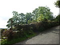
9

Woodland railway station (site), Cumbria
Opened in 1859 by the Furness Railway on the branch line from Foxfield to Coniston. The railway track ran left to right across the road and in front of the building.
Image: © Nigel Thompson
Taken: 13 Jul 2013
0.16 miles
10

Ordnance Survey Cut Mark
This OS cut mark can be found on the gatepost of the Old Post Office. It marks a point 67.310m above mean sea level.
Image: © Adrian Dust
Taken: 2 Feb 2020
0.17 miles