
IMAGES TAKEN NEAR TO
Sandside, KIRKBY-IN-FURNESS, LA17 7UA
Introduction
This page details the photographs taken nearby to Sandside, LA17 7UA by members of the Geograph project.
The Geograph project started in 2005 with the aim of publishing, organising and preserving representative images for every square kilometre of Great Britain, Ireland and the Isle of Man.

There are currently over 7.5m images from over14,400 individuals and you can help contribute to the project by visiting https://www.geograph.org.uk
Image Map
Images are licensed for reuse under creativecommons.org/licenses/by-sa/2.0
Notes
- Clicking on the map will re-center to the selected point.
- The higher the marker number, the further away the image location is from the centre of the postcode.
Image Listing (13 Images Found)
Images are licensed for reuse under creativecommons.org/licenses/by-sa/2.0
Image
Details
Distance
1

Ordnance Survey Cut Mark
This damaged OS cut mark can be found on Waters Edge west side of the road. It marks a point 5.823m above mean sea level.
Image: © Adrian Dust
Taken: 27 Feb 2022
0.06 miles
2

Excursion at Kirkby in Furness
Special excursion train passing Kirkby in Furness.
Image: © Wayland Smith
Taken: 9 Oct 2010
0.06 miles

4

Kirkby-in-Furness railway station, Cumbria
Opened in 1846 by the Furness Railway on the line from Carlisle to Barrow-in-Furness. View north towards Foxfield and Carlisle.
Image: © Nigel Thompson
Taken: 13 Jul 2013
0.13 miles
5

Footbridge, Kirkby-in-Furness Railway Station
Kirkby-in-Furness is a railway station on the Cumbrian Coast Line between Carlisle and Barrow-in-Furness. The station is 9¼ miles (15 km) north of Barrow-in-Furness and is served by Northern trains. The station is unstaffed.
Little remains from the original station which was opened in 1846; there are no longer any permanent buildings at the station apart from a footbridge and shelters on each platform (this one on the northbound one being the more substantial).
Image: © David Dixon
Taken: 2 Jul 2024
0.15 miles
6
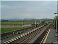
Kirkby in Furness
The train is an excellent way of reaching the west coast of Cumbria
Image: © Carl Bendelow
Taken: 3 Sep 2002
0.15 miles
7

Milestone, Askewgate Brow
On a cornerstone of the house opposite the Ship Inn.
ULVERSTOᴺ / 5 ML
Milestone Society National ID: LA_ULV05
Image: © Michael Cowperthwaite
Taken: 1 Dec 2020
0.16 miles
8

Kirkby-in-Furness Railway Station
Kirkby-in-Furness is a railway station on the Cumbrian Coast Line between Carlisle and Barrow-in-Furness. The station is 9¼ miles (15 km) north of Barrow-in-Furness and is served by Northern trains. The station is unstaffed.
Little remains from the original station which was opened in 1846; there are no longer any permanent buildings at the station apart from a footbridge and shelters on each platform.
Image: © David Dixon
Taken: 2 Jul 2024
0.17 miles
9

Ordnance Survey Rivet
This OS rivet can be found on the wall north side of the road. It marks a point 22.275m above mean sea level.
Image: © Adrian Dust
Taken: 25 Feb 2022
0.18 miles
10
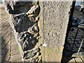
Ordnance Survey Cut Mark
This OS cut mark can be found on the gatepost NW side of the road. It marks a point 26.665m above mean sea level.
Image: © Adrian Dust
Taken: 27 Feb 2022
0.20 miles