
IMAGES TAKEN NEAR TO
Blea Beck, ASKAM-IN-FURNESS, LA16 7DG
Introduction
This page details the photographs taken nearby to Blea Beck, LA16 7DG by members of the Geograph project.
The Geograph project started in 2005 with the aim of publishing, organising and preserving representative images for every square kilometre of Great Britain, Ireland and the Isle of Man.

There are currently over 7.5m images from over14,400 individuals and you can help contribute to the project by visiting https://www.geograph.org.uk
Image Map
Images are licensed for reuse under creativecommons.org/licenses/by-sa/2.0
Notes
- Clicking on the map will re-center to the selected point.
- The higher the marker number, the further away the image location is from the centre of the postcode.
Image Listing (15 Images Found)
Images are licensed for reuse under creativecommons.org/licenses/by-sa/2.0
Image
Details
Distance
1
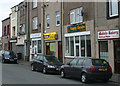
Village Shops, Askam in Furness, Cumbria
Image: © James Cocker
Taken: 27 Jan 2008
0.09 miles
2
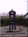
Fountain at Askam in Furness
Celebrating Queen Victoria's Diamond Jubilee 1897. Has the cryptic inscription 'Keep the pavement dry' on it.
Image: © Michael Graham
Taken: Unknown
0.15 miles
3
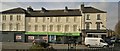
The Co-operative shop
Looks well maintained, but what use is being made of those upper two stories? Once living quarters they're probably now empty.
Image: © Chris Morgan
Taken: 27 Feb 2015
0.16 miles
4
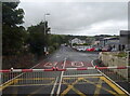
Ireleth Road (A595), Askam in Furness
View from the level crossing.
Image: © JThomas
Taken: 5 Jul 2021
0.18 miles
5
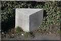
Old Milestone by the A595, Askam in Furness
Carved stone post by the A595, in parish of ASKAM AND IRELETH (BARROW IN FURNESS District), Askam Railway Station, in pavement, on North side of road. Lancashire CC stone triangle, erected by the County Council in the 19th/20th century.
Inscription reads:-
: BROUGHTON 8¾ MLS : : DALTON : : DALTON 3 MLS / BARROW 6 MLS :
Milestone Society National ID: LA_DABR03.
Image: © CF Smith
Taken: 7 Mar 2010
0.18 miles
6
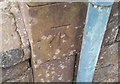
Ordnance Survey Cut Mark
This OS cut mark can be found on the south angle of the Railway Station. It marks a point 11.891m above mean sea level.
Image: © Adrian Dust
Taken: 15 Oct 2019
0.18 miles
7
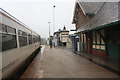
A Northern service calls at Askam-in-Furness Station on its way to Carlisle
Image: © Roger Templeman
Taken: 16 Aug 2019
0.19 miles
8
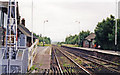
Askam station, 1998
View northward, towards Millum and Whitehaven: ex-Furness Railway, Carnforth - Barrow - Whitehaven secondary main line.
Image: © Ben Brooksbank
Taken: 1 Jul 1998
0.20 miles
9

Askam railway station, Cumbria
Opened in 1851 as "Ireleth Gate" by the Furness Railway on the line from Carlisle to Barrow-in-Furness, this station was renamed "Ireleth" in 1868 (after 10 years of closure), and then became "Askam" in 1875.
View north towards Kirkby-in-Furness and Carlisle.
Image: © Nigel Thompson
Taken: 13 Jul 2013
0.20 miles
10
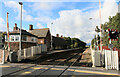
Askam in Furness Railway Station
Askam in Furness Railway Station viewed from the level crossing
Image: © Mr S Mudgey
Taken: 17 Sep 2015
0.20 miles