
IMAGES TAKEN NEAR TO
Millar Court, LANCASTER, LA1 5XB
Introduction
This page details the photographs taken nearby to Millar Court, LA1 5XB by members of the Geograph project.
The Geograph project started in 2005 with the aim of publishing, organising and preserving representative images for every square kilometre of Great Britain, Ireland and the Isle of Man.

There are currently over 7.5m images from over14,400 individuals and you can help contribute to the project by visiting https://www.geograph.org.uk
Image Map
Images are licensed for reuse under creativecommons.org/licenses/by-sa/2.0
Notes
- Clicking on the map will re-center to the selected point.
- The higher the marker number, the further away the image location is from the centre of the postcode.
Image Listing (29 Images Found)
Images are licensed for reuse under creativecommons.org/licenses/by-sa/2.0
Image
Details
Distance
1

Brettarch Drive, Haverbreaks
A quiet, private residential area on the southwest outskirts of Lancaster.
Image: © M J Richardson
Taken: 14 Oct 2011
0.08 miles

3

Lancaster, Ashton Road
The A588 towards Lancaster.
Image: © David Dixon
Taken: 17 Mar 2019
0.10 miles
4

Rising Bollard at Haverbreaks
An anti rat-running measure on the private estate in Lancaster.
Image: © M J Richardson
Taken: 14 Oct 2011
0.11 miles
5

The summer house, Springfield Hall, Lancaster
The scouts were from 3rd Altrincham Scout Group, and were en route by bicycle to Lowes Water in the Lake District to assist with the war effort, by cutting pit props. The owner of Springfield Hall allowed them to 'camp' for the night in the summer house.
Photograph by Geoffrey William Sutcliffe (1907-2004), the contributor's father
Image: © Geoffrey William Sutcliffe
Taken: Unknown
0.11 miles
6

Ashton Road (A588) heading north at Haverbreaks
Towards Lancaster.
Image: © JThomas
Taken: 16 Nov 2013
0.12 miles
7

Haverbreaks, Lancaster
The humps are not the real cause for concern today.
Image: © Michael Graham
Taken: 22 Dec 2009
0.13 miles
8
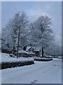
North Lodge
The lodge is in the grounds of a former very large Hospital, The Royal Albert.
Image: © Michael Graham
Taken: 22 Dec 2009
0.13 miles

10

Bridge Road
Looking towards Ashton Road after passing under the railway bridge
Image: © Michael Graham
Taken: 22 Dec 2009
0.14 miles