
IMAGES TAKEN NEAR TO
LA1 5WH
Introduction
This page details the photographs taken nearby to LA1 5WH by members of the Geograph project.
The Geograph project started in 2005 with the aim of publishing, organising and preserving representative images for every square kilometre of Great Britain, Ireland and the Isle of Man.

There are currently over 7.5m images from over14,400 individuals and you can help contribute to the project by visiting https://www.geograph.org.uk
Image Map
Images are licensed for reuse under creativecommons.org/licenses/by-sa/2.0
Notes
- Clicking on the map will re-center to the selected point.
- The higher the marker number, the further away the image location is from the centre of the postcode.
Image Listing (29 Images Found)
Images are licensed for reuse under creativecommons.org/licenses/by-sa/2.0
Image
Details
Distance
1
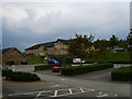
Oaklands
An NHS facility built by private finance and leased to the NHS. It was one of three units in the area which replaced the Lancaster Moor Hospital in 1999.
Image: © Michael Graham
Taken: 25 Jul 2008
0.08 miles
2

Haverbreaks
Sheep graze (or try to in the snow!) on what is potentially a prime Lancaster development site - except the residents of the Haverbreaks estate beyond bought the land to prevent this.
Image: © Karl and Ali
Taken: 5 Jan 2010
0.10 miles
3

Grazing Land, Haverbreaks
From the road in the estate. Haverbreaks is a private housing estate where some of the wealthier citizens of Lancaster live. Haverbreaks means 'Slope where Oats grow'
Image: © Michael Graham
Taken: 19 May 2008
0.10 miles
4

Former bandstand for the Royal Albert Hospital
For the benefit of patients and staff at the former Royal Albert Hospital a large Victorian mental institution. Nearby buildings and fields were once a farm where patients grew food (and looked after animals - a therapeutic practice which carried on into the 1990s). This aspect of Victorian care seems relatively benign and enlightened.
Image: © Karl and Ali
Taken: 30 Nov 2009
0.10 miles
5

Haverbreaks
Haverbreaks is a residential area and a grassy slope - seen here from across the canal.
Image: © Karl and Ali
Taken: 11 Feb 2010
0.10 miles
6

On Ashton Road
Looking towards Haverbreaks
Image: © Michael Graham
Taken: 22 Dec 2009
0.11 miles

8

North Barn
Converted barn formerly part of Royal Albert Farms a Victorian hospital for persons with a Learning Disability. Of course the Victorians used a less flattering term.
Image: © Michael Graham
Taken: 25 Jul 2008
0.13 miles
9

Royal Albert Gatehouse
Gatehouse to the former Royal Albert Hospital, now a college, beside the A588 Ashton Road.
Image: © David Rogers
Taken: 12 Jul 2010
0.13 miles
