
IMAGES TAKEN NEAR TO
Gilpin Close, LANCASTER, LA1 5TD
Introduction
This page details the photographs taken nearby to Gilpin Close, LA1 5TD by members of the Geograph project.
The Geograph project started in 2005 with the aim of publishing, organising and preserving representative images for every square kilometre of Great Britain, Ireland and the Isle of Man.

There are currently over 7.5m images from over14,400 individuals and you can help contribute to the project by visiting https://www.geograph.org.uk
Image Map
Images are licensed for reuse under creativecommons.org/licenses/by-sa/2.0
Notes
- Clicking on the map will re-center to the selected point.
- The higher the marker number, the further away the image location is from the centre of the postcode.
Image Listing (27 Images Found)
Images are licensed for reuse under creativecommons.org/licenses/by-sa/2.0
Image
Details
Distance
1
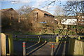
Entrance onto the Greenway
The access at this point is through the Asda site. The Greenway is the route of a dismantled railway between Lancaster and Morecambe which forms part of a Coast to Coast bike route.
Image: © Bill Boaden
Taken: 28 Feb 2014
0.08 miles
2
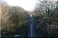
Lancaster-Morecambe Greenway
Part of a 3 mile bike and pedestrian route, as seen from Ovangle Bridge.
Image: © Bill Boaden
Taken: 28 Feb 2014
0.08 miles
3
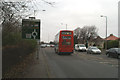
The No. 40 goes on its way to Morecambe
Having taken me to my destination.
Image: © David Long
Taken: 23 Dec 2008
0.08 miles

5
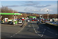
Vehicle entrance to Asda Lancaster
The superstore is off to the right. This view has the main Lancaster landmarks in the distance.
Image: © Bill Boaden
Taken: 28 Feb 2014
0.10 miles
6

Heaton Hall, Lancaster
Quite a grand house that is now a hotel, pub and place for functions.
Image: © Karl and Ali
Taken: 23 Mar 2010
0.10 miles
7

Cyclists on the Greenway
Heading south-east on the former railway line, now part of the Lancashire Coastal Way.
Image: © Christine Johnstone
Taken: 10 Oct 2013
0.11 miles
8

Homes on Scale Farm Road
Seen from the Greenway, a former railway line.
Image: © Christine Johnstone
Taken: 10 Oct 2013
0.11 miles
9
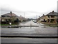
Penrhyn Road, Morecambe
Looking along Penrhyn Road from its junction with Morecambe Road, Morecambe. The road provides access into Scales Hall housing estate.
Image: © Graham Robson
Taken: 8 Nov 2013
0.12 miles
10
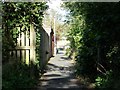
Alley linking the Greenway and Roeburn Drive
'Gulley', 'jitty' or 'ginnel', depending on your dialect.
Image: © Christine Johnstone
Taken: 10 Oct 2013
0.13 miles