
IMAGES TAKEN NEAR TO
Milking Stile Lane, LANCASTER, LA1 5QD
Introduction
This page details the photographs taken nearby to Milking Stile Lane, LA1 5QD by members of the Geograph project.
The Geograph project started in 2005 with the aim of publishing, organising and preserving representative images for every square kilometre of Great Britain, Ireland and the Isle of Man.

There are currently over 7.5m images from over14,400 individuals and you can help contribute to the project by visiting https://www.geograph.org.uk
Image Map
Images are licensed for reuse under creativecommons.org/licenses/by-sa/2.0
Notes
- Clicking on the map will re-center to the selected point.
- The higher the marker number, the further away the image location is from the centre of the postcode.
Image Listing (48 Images Found)
Images are licensed for reuse under creativecommons.org/licenses/by-sa/2.0
Image
Details
Distance
1

Westfield Memorial Village, Lancaster
Westfield Memorial Village originated after the 1st World War. A Lancaster Industrialist, Herbert Storey, donated the land and in 1918 the landscape architect, Thomas Mawson designed the Village. A committee was formed which became a charity in 1919 with the primary aim of providing residential accommodation for Disabled and Necessitous Members and Ex-Members of HM Forces and their relatives and dependants who came from Lancashire and the North West of England. Finance was raised locally by public subscription and the first stage of the Village was completed and opened on 27th November 1924 by Field Marshal Earl Haig. Many of the houses are in the 'Arts and Crafts' style.
Image: © Humphrey Bolton
Taken: 20 Dec 2007
0.03 miles
2

Doorway to the Herbert Storey Cottage, Westfield Village, Lancaster
The plaque reads: “The War Memorial Village / Lancaster / This stone was laid by the Honourable ..(?).. 15th November 1919. Herbert Storey donated the land for the village, which was designed by Thomas Mawson.
Image: © Humphrey Bolton
Taken: 20 Dec 2007
0.03 miles
3

OS Bench Mark
OS cut bench mark from the 19th century levelling, on No.26 Milking Stile Lane. 31.7 feet above old datum.
Image: © Phil Johnstone
Taken: 13 Oct 2021
0.06 miles
4

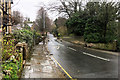
Milking Stile Lane heading towards Westbourne Road
Image: © Roger Templeman
Taken: 25 Jul 2026
0.06 miles
5
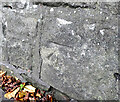
OS Bench Mark
OS cut bench mark from the 19th century levelling, on south side of Westbourne Road 13 m SW of Westbourne Drive. 60.5 feet above old datum. Weathered and hard to spot.
Image: © Phil Johnstone
Taken: 13 Oct 2021
0.08 miles
6
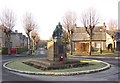
War Memorial, Westfield Memorial Village, Lancaster
This is the centre-piece of this housing estate for war veterans.
Image: © Humphrey Bolton
Taken: 20 Dec 2007
0.09 miles
8
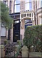
Canopies, Westbourne Road, Lancaster
Quite elaborate wooden canopies to shelter the doors.
Image: © Humphrey Bolton
Taken: 20 Dec 2007
0.09 miles
9

Houses, Willow Lane, Lancaster
Former council houses, I think. The two inner doors of the block of four houses look to have their original canopies. The outer pair are interesting, like miniature porches.
Image: © Humphrey Bolton
Taken: 20 Dec 2007
0.10 miles
10

Laurel Bank Care Home on NW side of Westbourne Road
Image: © Roger Templeman
Taken: 25 Jul 2026
0.10 miles