
IMAGES TAKEN NEAR TO
Stanley Place, LANCASTER, LA1 5PN
Introduction
This page details the photographs taken nearby to Stanley Place, LA1 5PN by members of the Geograph project.
The Geograph project started in 2005 with the aim of publishing, organising and preserving representative images for every square kilometre of Great Britain, Ireland and the Isle of Man.

There are currently over 7.5m images from over14,400 individuals and you can help contribute to the project by visiting https://www.geograph.org.uk
Image Map
Images are licensed for reuse under creativecommons.org/licenses/by-sa/2.0
Notes
- Clicking on the map will re-center to the selected point.
- The higher the marker number, the further away the image location is from the centre of the postcode.
Image Listing (203 Images Found)
Images are licensed for reuse under creativecommons.org/licenses/by-sa/2.0
Image
Details
Distance
1

Salisbury Road, Lancaster
Part of a 19C suburb, not far from the docks and warehouses. The nicely carved door lintel in the foreground suggests that they were good quality houses.
Image: © Humphrey Bolton
Taken: 20 Dec 2007
0.05 miles
2

Bowling Green, Westfield Memorial Village, Lancaster
The Westfield Club is in the background, probably not part of the Memorial Village, but conveniently near to it.
Image: © Humphrey Bolton
Taken: 20 Dec 2007
0.05 miles
3

Old-style houses, Westfield Memorial Village, Lancaster
Were these built c.1920 in a 19C style, or were they already here when the village was started?
Image: © Humphrey Bolton
Taken: 20 Dec 2007
0.05 miles
4

Storey Avenue, Westfield Memorial Village, Lancaster
This housing estate for war veterans was built on land donated by the industrialist Herbert Storey in 1919-24.
Image: © Humphrey Bolton
Taken: 20 Dec 2007
0.05 miles
5
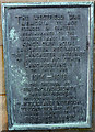
Plaque on the war memorial, Westfield Memorial Village, Lancaster
The plaque seen here Image
Image: © Karl and Ali
Taken: 8 Jan 2015
0.05 miles
6

OS Bench Mark
OS cut bench mark from the 19th century levelling, on gatepost of Nos. 43/45 Willow Lane. 22.3 feet above old datum.
Image: © Phil Johnstone
Taken: 13 Oct 2021
0.06 miles

8

OS Bench Mark
OS cut bench mark from the 19th century levelling, on gatepost of No.18 West Road. 29.64 feet above datum.
Image: © Phil Johnstone
Taken: 3 Oct 2021
0.07 miles
9

Cut benchmark, West Road, Lancaster
At an altitude of 9.016m asl.
Image: © Karl and Ali
Taken: 8 Jan 2015
0.08 miles
10

OS Bench Mark
OS cut bench mark from the 19th century levelling, on side wall of No.1 Willow Lane. 25.73 feet above datum. This mark is unusually high above ground level.
Image: © Phil Johnstone
Taken: 3 Oct 2021
0.09 miles