
IMAGES TAKEN NEAR TO
Windham Place, LANCASTER, LA1 5HA
Introduction
This page details the photographs taken nearby to Windham Place, LA1 5HA by members of the Geograph project.
The Geograph project started in 2005 with the aim of publishing, organising and preserving representative images for every square kilometre of Great Britain, Ireland and the Isle of Man.

There are currently over 7.5m images from over14,400 individuals and you can help contribute to the project by visiting https://www.geograph.org.uk
Image Map
Images are licensed for reuse under creativecommons.org/licenses/by-sa/2.0
Notes
- Clicking on the map will re-center to the selected point.
- The higher the marker number, the further away the image location is from the centre of the postcode.
Image Listing (19 Images Found)
Images are licensed for reuse under creativecommons.org/licenses/by-sa/2.0
Image
Details
Distance
1

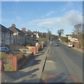
Cleveleys Avenue
Residential road on the north side of the Lune with Lancaster's Priory Church visible at the far end.
Image: © Bill Boaden
Taken: 28 Feb 2014
0.08 miles
3
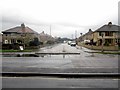
Penrhyn Road, Morecambe
Looking along Penrhyn Road from its junction with Morecambe Road, Morecambe. The road provides access into Scales Hall housing estate.
Image: © Graham Robson
Taken: 8 Nov 2013
0.11 miles
4

Vale of Lune
The Clubhouse where in years gone by much refreshment was taken.In the 80's I recal watching a top class Lancashire side give the Australians abit of a pasting on hard pitch with the snow falling.
Image: © Michael Graham
Taken: 17 Dec 2008
0.13 miles
5
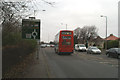
The No. 40 goes on its way to Morecambe
Having taken me to my destination.
Image: © David Long
Taken: 23 Dec 2008
0.14 miles
6
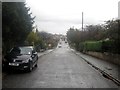
Burton Avenue, Scale Hall, Morecambe
Looking along Burton Avenue, one of the residential streets that form the Scale Hall area of Morecambe.
Image: © Graham Robson
Taken: 8 Nov 2013
0.15 miles
7

Vale of Lune RUFC
Rugby Union club playing in North 1 West.
Image: © Bill Boaden
Taken: 28 Feb 2014
0.16 miles
8

Old Boundary Marker on the A589 Morecambe Road
Municipal Boundary Marker on the northeast side of the A589 Morecambe Road, Lancaster, against the front garden wall of no.150. On the boundary of Skerton and Heaton with Oxcliffe parishes until 1900 when Skerton became part of Lancaster borough. The stone has been moved about 5 metres southeast from the line of the boundary and reused for the hydrant sign.
The inscription on the missing plate was likely to have been similar to that shown in https://www.geograph.org.uk/photo/7081907:-
LANCASTER CORPORATION
1900
----
BOROUGH
BOUNDARY.
Milestone Society National ID: LA_LANC04pb
Image: © C Leather
Taken: 11 Aug 2024
0.16 miles
9

Vale of Lune
Rugby Union Club's pitch at Scale Hall Lancaster
Image: © Michael Graham
Taken: 17 Dec 2008
0.18 miles
10

Modern Waymarker by A589, Torrisholme
Carved stone post by the A589, in parish of LANCASTER (LANCASTER District). To commemorate the opening of Morecambe Road (A589). The plaque reads -
This road was constructed by Men of Lancaster and Morecambe, who fought during the Great War, 1914-1918. Opened 12th October 1922.
J.R. NUTTALL Mayor of Lancaster
J.R. BIRKETT Mayor of Morecambe
Geo. JACKSON Chairman of the Joint Committee
Fred K. HILL, Surveyor
The sides of the plinth are engraved -
Lancaster Town Hall 2 1/4 miles
Morecambe Clock Tower 2 miles
Milestone Society National ID: LA_LAHM02A
Image: © Christopher Leather
Taken: 11 Aug 2024
0.18 miles