
IMAGES TAKEN NEAR TO
Charles Street, LANCASTER, LA1 4UU
Introduction
This page details the photographs taken nearby to Charles Street, LA1 4UU by members of the Geograph project.
The Geograph project started in 2005 with the aim of publishing, organising and preserving representative images for every square kilometre of Great Britain, Ireland and the Isle of Man.

There are currently over 7.5m images from over14,400 individuals and you can help contribute to the project by visiting https://www.geograph.org.uk
Image Map
Images are licensed for reuse under creativecommons.org/licenses/by-sa/2.0
Notes
- Clicking on the map will re-center to the selected point.
- The higher the marker number, the further away the image location is from the centre of the postcode.
Image Listing (66 Images Found)
Images are licensed for reuse under creativecommons.org/licenses/by-sa/2.0
Image
Details
Distance
1
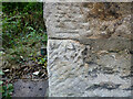
OS Bench Mark
OS cut bench mark from the first, 19th century, levelling, on house at corner of Alma Road and Greaves Road. 132.1 feet above old datum. Rather weathered.
Image: © Phil Johnstone
Taken: 24 Sep 2021
0.03 miles
2
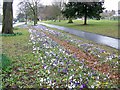
Colourful verge, Lancaster
The wide verge beside the A6 is a riot of colour with crocuses.
Image: © Maigheach-gheal
Taken: 22 Mar 2010
0.03 miles
3
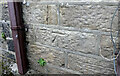
OS Bench Mark
OS cut bench mark from the first, 19th century, levelling, on house wall on Nos. 2/4 Railway Street. 112.7 feet above old datum.
Image: © Phil Johnstone
Taken: 24 Sep 2021
0.05 miles
4
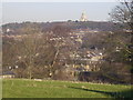
From Ripley Heights
Looking over Greaves and Bowerham towards Williamson's Park
Image: © Michael Graham
Taken: 13 Feb 2008
0.06 miles
5
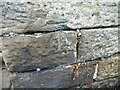
OS Bench Mark
OS cut bench mark from the first, 19th century, levelling, on garden wall of No.76 Greaves Road. 137.8 feet above old datum. Somewhat degraded.
Image: © Phil Johnstone
Taken: 24 Sep 2021
0.06 miles
6
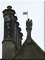
Winged figure and chimneys, Greaves Park, Lancaster
The figure clutching the flag has a beak and wings - a griffin perhaps?
Image: © Karl and Ali
Taken: 18 Jul 2012
0.10 miles
7

Greaves Park, Lancaster
A restaurant http://www.greavespark.co.uk/ set in a small, wooded park on the edge of the city centre.
Image: © Karl and Ali
Taken: 18 Jul 2012
0.10 miles
8
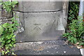
Benchmark on gatepost on NW side of Ashton Road
Ordnance Survey cut mark benchmark described on the Bench Mark Database at http://www.bench-marks.org.uk/bm77009
Image: © Roger Templeman
Taken: 13 Jul 2016
0.10 miles
9
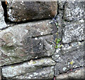
OS Bench Mark
OS cut bench mark from the first, 19th century, levelling, on wall opposite Royal Lancaster Infirmary. 112.7 feet above old datum. The wall was formerly the boundary of the first Lancaster railway station site, now a car park.
Image: © Phil Johnstone
Taken: 24 Sep 2021
0.11 miles
10
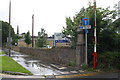
Cycle path/footpath off Ashton Road
There is an OS benchmark Image on the inside face of the gatepost
Image: © Roger Templeman
Taken: 13 Jul 2016
0.12 miles